


1.
20.
2.
21.
3.
22.
4.
23.
5.
24.
6.
25.
7.
26.
8.
27.
9.
28.
10.
29.
11.
30.
12.
31.
13.
32.
14.
33.
15.
34.
16.
35.
17.
36.
18.
37.
19.
38.








Northumberland Coast
This bright, wild, lonely coast sweeps along some of Britain's finest beaches and is internationally noted for its wildlife. The AONB, a narrow coastal strip, stretches from Berwick-upon-Tweed to Amble. Soft sandstone and limestone rocks dipping gently as a plain to the sea make this essentially a low-lying coast with long views. Open miles of beach are backed in places by extensive sand dunes and the AONB takes in the island of Lindisfarne and its treacherous intertidal flats, as well as the numerous small islands and rocks of the Farne Islands further out from the coast. Where the coastline is broken by the Whin Sill, ancient black basalt meets the sea in low headlands and rocky coves, dramatic setting for Bamburgh and Dunstanburgh Castles and shelter for working harbours such as Craster. Much of the coast is owned or managed by conservation organisations and includes many Sites of Special Scientific Interest. The dunes, marshes and mud-flats of the Lindisfarne National Nature Reserve are one of the best sites in Europe for waders and waterfowl and offshore, the Farne Islands are a protected seabird sanctuary. The AONB's dune systems are a particularly fine example of this fragile habitat. The local rural economy is based on mixed arable farming, livestock fattening and dairying together with fishing. The AONB, with a population of 12,500, includes small ports such as Seahouses and Alnmouth and some of Britain's last inshore fleets sail from its harbours. Tourism is an important supplement to the local economy. Although the coast is less intensively used than most, it attracts many peak period visitors, both as a holiday destination and as a day trip from nearby towns and Tyneside. The coast remains relatively undeveloped for tourism which is largely based on caravan and camp sites. There is no continuous coastal road or footpath running the length of the coast which contributes to and protects its remoteness.Solway Coast
Stretching along the Cumbrian shore of the Solway Firth, this is a low, open and windswept AONB with wide views across to the hills of Galloway. Physically part of the Solway Plain, the coast's characteristic feature is its continuous 7.6m raised beach. Silting along the estuary has left extensive marine deposits and the open foreshore strip now consists either of marine terrace with low, scrub-covered sandstone cliffs or undulating dunes. The falling tides expose wide sand stretches, intertidal mud-flats and, higher upstream, salt-marsh and peat moss, in a landscape with a sense of remoteness that is the essence of its value and character. With varied habitats and rich feeding grounds, the estuary is of outstanding wildlife importance. An overwintering ground for huge numbers of wildfowl, the Upper Solway's flats and marshes are a Ramsar site and seals, dolphins and porpoises have been sighted offshore. Glasson Moss National Nature Reserve is part of the largest undamaged area of lowland raised mire in Britain. Much of the foreshore has been bought, for its protection, by Cumbria County Council and conservation bodies. The area has a rich historical and cultural heritage associated with its position on the Scottish border. This is a traditional agricultural area remote from large towns. The AONB boundary skirts Silloth, the largest settlement and stops short of the fishing town of Maryport. Inshore fishing includes shrimping and cockles and the local village farming, by rotational cropping and grazing, has evolved from the traditional Cumbrian pattern with its 'statemen' communities of farmers. Small, hedged fields are still a dominant feature in the landscape. Tourism is an important, though relatively undeveloped, supplement to the local economy, concentrated in caravan sites at the small resorts of Silloth and Allonby. A number of archaeological sites include defences built by the Romans. The AONB is also a popular day trip destination for touring motorists from Carlisle, the West Cumbrian coast towns and Tyneside, and the shore road bears heavy peak season traffic. The Cumbria Cycle Way passes through the AONB and the proposed regional footpath, the Cumbria Coastal Way follows the foreshore and continues to Port Carlisle. A proposed National Trail will follow the line of Hadrian's Wall through the north of the AONB.North Pennines
An AONB protecting the wide empty miles of one of the country's last expanses of wilderness, the upland plateau, northern limit of the Pennine chain, stretches away in a high wild landscape of undulating heather moorland and blanket peat. On its western edge, the plateau ends sharply in a steep escarpment looking down on the green and gold patchwork of the Eden Valley. The table-top summit of Cross Fell (890m) is the highest point. The Tyne, Tees, Wear, Derwent and Allen rivers drain from the plateau forming valleys that each have their own distinct character. Ecologically, the North Pennines are of outstanding value. The AONB is rich in wildlife and includes herb-rich hay meadows, juniper, alpine limestone flora and a diversity of moorland and wading birds. Parts are protected as National Nature Reserve and sites of special scientific interest. Britain’s first international biosphere reserve was designated in the North Pennines and it is expected that, under European legislation, the status of Special Protection Area (SPA) was to be confirmed later in 1998. The AONB also includes parts of the Pennine Dales Environmentally Sensitive Area. The Upper Teesdale and Moorhouse National Nature Reserves are of international significance. Hill farming (mainly sheep) is important to the rural economy and is complemented by moorland management for grouse shooting. Other economic activities include the quarrying of limestone and mineral working in the Durham sector. The North Pennines was once the lead mining centre of the world and the ruined traces of abandoned lead mines are now acknowledged as an intrinsic part of the landscape and its heritage. There are no major towns within the AONB and its largest settlements are Allendale Town and Alston. The scattered stone villages throughout the area have experienced a significant reduction in population following the decline in the traditional lead mining industry from the late 19th century. Typically, they are remote rural villages, where young people tend to leave for jobs elsewhere and the remaining population (fewer than one person per square kilometre) experience the knock on effect of losses of shops, post offices and other rural services. Recent years have seen a modest increase in inward migration and tourism which, to some extent, is helping to stem the decline. The AONB's countryside, historic villages and industrial heritage are the essential components in comprehensive new strategies to promote sensitive tourism. The National Trails of the Pennine Way and the developing Pennine Bridleway pass through the area, as does the Teesdale Way, a recreational route. Other initiatives to create recreational routes in the area are underway.Arnside & Silverdale
The AONB’s intimate, green and silver landscape rises from the shores of Morecambe Bay, with wide views over the Kent Estuary to the Lake District. Despite its small scale, the AONB shows a unique interweaving of contrasting countryside. The area is characterised by small scale limestone hills rising to less than 100m in height, fine deciduous woodlands and valleys which form sheltered agricultural land. The inter-relationship of salt-marsh, limestone cliffs and reclaimed mosses, at or about sea level, contrast markedly with limestone pasture, rock outcrops and limestone pavements at a higher level. The distribution of copses and hedgerows and the pattern of limestone walls create a strong feeling of enclosure, and are important elements in the landscape. Varied geology and vegetation added to a notably mild climate at this northerly latitude, makes this AONB extremely important as a diverse natural habitat. Unimproved pasture and the exposed limestone outcrops are rich in rare butterflies and flowers. Between the limestone hills there are drift deposits and estuarine silts and clays which, close to the estuaries, support nationally important lowland raised mires. Woodlands are a distinctive element in the landscape with significant areas of ancient semi-natural woodland. Large areas are owned by the National Trust, English Nature and the Royal Society for the Protection of Birds as well as local wildlife trusts and conservation organisations. The reed and willow swamps of RSPB Leighton Moss are a major breeding site for marshland birds which include bearded tits, marsh harrier and the rare bittern. The sands and salt-marshes of Morecambe Bay are internationally important for wading birds and wildfowl. Parts of the AONB are of recognised national and international importance for wildlife. Farming is, in the main, livestock, with sheep being grazed on the higher rough pastures and cattle and sheep farmed on the reclaimed valley soils. Some active quarrying remains and a small portion of the AONB is commercial conifer plantation. Private land ownership is concentrated on two large estates. Arnside, Silverdale and Warton are the main centres of population and are popular for commuter, retirement and second-home housing. The AONB is a popular destination for quiet outdoor recreation, caravaning and day visitors.Forest of Bowland
The essential landscape character of the Forest of Bowland is one of grandeur and isolation. The AONB, geologically part of the main Pennine range, is dominated by a central upland core of deeply incised gritstone fells with summits above 450 m and vast tracts of heather-covered peat moorland. The fells' fringe of foothills is dissected by steep-sided valleys which open out into the rich green lowlands of the Ribble, Hodder, Wyre and Lune Valleys. Well-wooded and dotted with picturesque stone farms and villages, these lower slopes, criss-crossed by drystone walls, contrast with and complement the dramatic open sweep of the gritstone heights. On its southeastern edge, famous Pendle Hill forms an outlier to the AONB. Bowland's ecological features make it a nationally important area for nature conservation and 13 per cent is designated as Sites of Special Scientific Interest. The moors are a major breeding ground for upland birds and the major part of the Bowland Fells is designated as a Special Protection Area under the European Birds Directive. The lowlands contain important ancient woodland habitat. Building in Bowland, is in local gritstone and has a strong vernacular style which adds, rather than detracts, to the quality of the landscape. Population (15,000) is scattered, and traditional villages such as Slaidburn and Newton have seen very little modern development. Sheep and beef farming predominates in the uplands with dairying being the major land use in the valleys. There is some forestry, water catchment and mineral extraction. Increasingly, tourism is adding extra income to the local rural economy. The growing numbers of day visitors underline the fact that Preston, Lancaster and the towns of north east Lancashire lie close to the AONB and one million people live within a 30 minute journey.Nidderdale
Nidderdale is located on the eastern flanks of the Yorkshire Pennines stretching from the high moorland of Great Whernside south and east towards the edge of the Vale of York. The area is crossed by deep pastoral, often wooded dales of the Washburn, Laver, Burn and the long majestic dale of the Nidd itself. Reservoirs add a further dimension to the beauty of the dale. Rich, rolling and wooded pastoral scenery, with stone settlements like Lofthouse and Kirkby Malzeard, contrast with bleak heather moorland which is broken by craggy gritstone outcrops, including the curious shapes of Brimham Rocks. To the east, in the wooded pasture lands of the Skell Valley, stands the internationally renowned and much visited Studley Royal, with the picturesque ruins of Fountains Abbey. The landscape is dominated by its millstone grit geology giving it a typically dark, sometimes sombre appearance which is reflected in the stone of buildings and walls, in the heather moorland and in the characteristic grasslands that occur on this type of formation. Glaciation and the differential resistance to weathering of the sand, shale and gritstones produces some of the most dramatic features such as cut off crags on valley sides and wide U-shaped valleys. This is in contrast with the pastoral landscapes of the dales and upland fringes running down to the dale. Hamlets and villages built in local stone contribute greatly to the character of the area.Howardian Hills
The Howardian Hills form a distinctive, roughly rectangular area of well-wooded undulating countryside rising, sometimes sharply, between the flat agricultural plains of Pickering and York. Jurassic limestone gives the landscape its character and in effect, the irregular 180m ridges of the Howardian Hills are a southern extension of the rocks of the North York Moors. It contains a rich and intimate tapestry of wooded hills and valleys, pastures and rolling farmland, as well as dramatic views from the higher ground across the agricultural plains below. On the eastern edge, the river Derwent cuts through the Hills in the Kirkham Gorge, a deep winding valley which was formed as an overflow channel from glacial Lake Pickering. The AONB contains no towns, although the market towns of Helmsley and Malton lie just beyond the boundary, but the area has many attractive stone-built, red pantile-roofed villages. The area is probably most famous as the setting for a number of fine country houses, whose parklands are an intrinsic part of the landscape value. Most notable is Vanbrugh's famous masterpiece, Castle Howard. Combining high grade arable land, pasture and managed woodland, this is rich farming country whose very diversity creates its attractive rural character.Lincolnshire Wolds
The chalk hills of the Lincolnshire Wolds roll northwest- southeast between the Humber and the Wash. A peaceful and expansive landscape with fine views, the Wolds have been sheep country for centuries. Now much of the traditional open grassland and hedged fields have been ploughed up for arable farming but precious stretches survive in the valleys and on steep slopes. Topographically, the Wolds are a dissected chalk tableland, falling gently eastward from a western scarp face which crests in pleasing contrast above the midland plain. High plateaux and ridges in the north give way to rounded hills crossed by winding valleys and narrow ravines. The grasslands and abandoned chalk pits are an important habitat for rare flowers and insects and some areas of fine mixed woodland are managed to conserve their traditional oak, ash and hazel coppice. Always sparsely settled, this is nevertheless a historical landscape with prehistoric barrows, ancient tracks and the distant spires of fine medieval churches. The AONB's rural economy is based on arable farming with intensive, large cereal units together with some mineral extraction. There are no large towns but many unspoilt villages which are increasingly used by commuters working in nearby Louth, Grimsby and Market Rasen. This is not as yet a well-known tourist area, though literary pilgrims visit pretty, red-roofed Somersby, to see the home and the landscape which inspired the poet Tennyson. The 'Tennyson Country' connection is now being promoted, as is green tourism, based around the long-distance Viking Way footpath. Seaside Mablethorpe, Skegness and Cleethorpes, all a short distance from the AONB, are obvious visitor centres. Local recreational demand is for traditional country pursuits such as walking or hunting and shooting, together with driving for pleasure on the open, lightly trafficked roads.Anglesey
Almost the entire 201 km coastline of Ynys Mon, the ancient Isle of Anglesey, is designated as an AONB. The island contains a great variety of fine coastal landscapes. The AONB coincides with stretches of Heritage Coast. Some of the oldest rocks in Britain, the pre-Cambrian Mona Complex, form the low ridges and shallow valleys of Anglesey's sea-planed plateau. Holyhead Mountain is its highest point (219m) with superb distant views to Snowdonia. Low cliffs, alternating with coves, pebble beaches and tucked-away villages, line the island's northern shores. The east coast's sheer limestone cliffs, interspersed with fine sandy beaches, contrast with the south's wilderness of sand dunes that roll away down to Aberffraw Bay. Varied habitats, from marine heaths to mud-flats, give the AONB a high level of marine, botanical and ornithological interest. The dunes of Newborough National Nature Reserve are a noted example of this complex habitat and the island's limestone cliffs are an important nesting site. Anglesey has an important historic landscape, with its protected sites ranging from Bronze Age burial chambers to medieval Beaumaris Castle. Two areas within the AONB are listed in the Register of Landscapes of Outstanding Historic Interest in Wales. The AONB's rural economy is traditionally based on small-mixed-agricultural holdings, although the number has fallen by 44 per cent since 1945. Significant local industry skirted by the AONB includes Wylfa nuclear power station, aluminium smelting and bromine extraction. The AONB contains no sizeable towns and residents of its coastal villages increasingly commute to work on the mainland. Tourism plays a significant part in the rural economy, largely centred on static caravan sites. The AONB is also an important recreation area both for local people, for day visitors from the Bangor mainland and also for urban north-west England. Sailing, riding, sea fishing, diving and cliff climbing are just some of the leisure demands on the AONB coastline. A circular island footpath is currently being developed.Llyn Peninsula
Nowhere is far from the sea on the long, low peninsula of Llyn, which is famous for the unspoilt beauty of its coastline. The AONB, covering a quarter of the peninsula, is largely coastal, but extends inland to take in the volcanic domes which punctuate the plateau. A marine-eroded platform, Llyn is in fact a natural extension of the Snowdonian Massif, with complex geology including ancient pre-Cambrian rocks. This varied geology is reflected in a succession of superb coastal landscapes, from the steep craggy cliffs around Aberdaron Bay to sandy bays and headlands and fine dune systems. Llyn's highest points are the north's abrupt volcanic peaks dominated by the granite crags of Yr Eifl (564m). At its foot, a landscape of hedged fields and rough pastures rolls out towards the sea and finally to the sheer black cliffs of Mynydd Mawr, the tip of the peninsula. The countryside is characterised by its narrow lanes and white-washed farms and includes stretches of ancient open common. Ynys Enlli (Bardsey Island), sea bird sanctuary and home to grey seals, is just one of Llyn's many notable wildlife sites. Llyn's landscape has a rich historic legacy with field monuments dating from Mesolithic times and spectacularly sited Iron Age hill-forts such as Yr Eifl's Tre'r Ceiri. The majority of the AONB is listed in the Register of Landscapes of Outstanding Historic Interest in Wales. Llyn's farming pattern is of small-scale, traditional, family farms raising sheep and cattle with dairying on pockets of better pasture. The few sizeable settlements of the AONB are the former fishing villages such as Abersoch and Nefyn, now bustling tourist centres. A predominantly Welsh-speaking area, Llyn has experienced the problems of outmigration of its young and working population and a rise in non-Welsh-speaking residents. In the Abersoch hinterland, a high percentage of houses are second homes. Tourism, particularly water sports, is central to the local economy. The south coast, with its fine facilities many moorings, is one of Britain's leading sailing centres. Diving, waterskiing and windsurfing are also major visitor activities. The AONB is a very popular caravan and camping destination.Clwydian Range
The Clwydian Range and Dee Valley is a designated Area of Outstanding Natural Beauty and proposed national park, located in north-east Wales, covering the Clwydian Range and the valley of the River Dee from Prestatyn in the North to Llangollen in the South. Designated in 1985 as the Clwydian Range and expanded in 2011 to include the area to the south around Llangollen. The area includes limestone crags, wooded valleys, medieval field systems, prehistoric hillforts, open heather moorland, broad leaved woodland, and farmland. Offa's Dyke Path and the Clwydian Way pass through this sparsley populated AONB and extends over part of the fantastic Pontcysyllte Aqueduct and Canal UNESCO World Heritage Site.Shropshire Hills
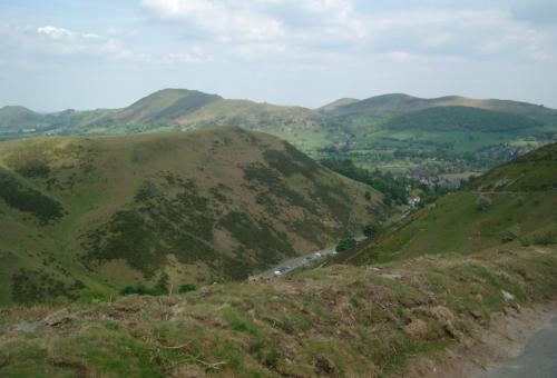
This is a distinctive area of the Anglo-Welsh borders where remote upland merges into pastoral lowland. The AONB's parallel hills and valleys run southwest, northeast with the strike of the rocks forming the Long Mynd and Stiperstones, Clun Forest, the Clee Hills, Stretton Hills and The Wrekin, five distinctive upland areas each with their own landscape character. The steep-sided rift valley of Church Stretton lies at the centre of the AONB and from its fertile farmed floor looms the great pre-Cambrian moorland ridge of the Long Mynd. The unmistakable peak of the Wrekin is a volcanic outlier and the lonely sandstone Clee Hills owe their rounded mass to a basalt cap. In contrast, the limestone outcrop of Wenlock Edge has an altogether softer, wooded character. The WrekinAreas of the AONB's open common are important upland habitat, including the heather moorland of the Stiperstones Ridge, a National Nature Reserve. In the southwest of the AONB, the smooth, rounded hills and high plateau of the Clun Forest have been designated an Environmentally Sensitive Area (ESA) to protect the small hedged fields, oak woods and pastures of the traditionally farmed landscape. The uplands of the Stiperstones, Long Mynd, Stretton Hills and Clee Hills have also been designated an ESA to protect the upland character of the area. Agriculture is a major employer and the hills and dales of south Shropshire are traditional sheep and beef farming country with cereals and dairying in favoured areas. The AONB, with a population of approximately 37,500, has no large towns but contains many rural villages and hamlets and the country market centres of Church Stretton, Craven Arms and Clun. On its northern borders, the economic growth of Shrewsbury and Telford has major development and leisure use implications for the AONB. The Shropshire Hills are an important recreational area for the towns of the Welsh border, and for visitors from the West Midlands, and the ridge footpaths are traditionally popular walking country. Although not a well-known tourist region, tourism is a planned growth area in the rural economy.Cannock Chase
Although the second smallest of the AONBs, Cannock Chase, with its doorstep conurbations and coveted mineral deposits, is potentially one of the most threatened of the protected landscapes. As its name suggests, the Chase was once the expansive sweep of a great medieval royal hunting forest. Today it is a surprisingly remote area of high sandstone heather and bracken heathland with birch woodland and extensive pine plantations. Dissected by secluded valleys and framed by a gentler landscape of fine parklands and attractive villages, the AONB encloses the last oak remnant of the ancient Cannock Forest. Its unenclosed, semi-natural landscapes provide a valuable contrast to the ordered agricultural landscapes dominating the Midlands region. Wild deer still roam the Chase, which is an important oasis in the urban Midlands. Its heathland, woodland and valley wetland habitats are protected as Sites of Special Scientific Interest (SSSIs) and large extents are local authority owned. The heaths are the largest surviving area of heathland in the Midlands and are transitional between the high altitude moorlands of the north and lowland heaths in the south of the country. They are valuable habitats for invertebrates along with the rare nightjar, lizards and adders. 1,214 hectares of the AONB are conserved as one of Britain's largest country parks. Its motorless zone, nature trails and reserves focus strongly on landscape and wildlife interest. Castle Ring, an Iron Age fort, has wide views over the Trent Valley. The AONB is ringed by towns such as Cannock and Rugeley and is within commuting distance of Wolverhampton. Land use includes mixed agriculture on the lower slopes plus significant sand and gravel extraction. The Forestry Commission has sizeable commercial plantations. Cannock Chase is an important recreation area, both as traditional Midlands daytrip country and for the growing population on its immediate fringe. 1.9 million people live within 30 kilometres of the AONB and although not a holiday area as such, peak season sees an ad hoc demand for camping and caravan pitches. The Chase is crossed by many footpaths and bridleways, including Forestry Commission trails and the Staffordshire Way. The variety of the landscape with enclosed woodlands and open views over the hills makes it feel larger than it actually is, which helps in its ability to accommodate the many thousands of visitors attracted by its scenery.Norfolk Coast
The AONB, a long coastal strip, incorporates the finest, remotest and wildest of Norfolk's renowned marsh coastlands. It includes the silt expanses of the Wash, the north-facing coastal marsh and dunes of the Heritage Coast and the high boulder clay cliffs east of Weybourne which the sea is rapidly eroding away. The coast is backed by gently rolling chalkland and glacial moraine including the distinctive 90-m high Cromer Ridge. An undulating, intimate landscape under huge skies, the AONB is characterised by its imposing churches and quiet brick and flint villages and small towns such as Wells-next-the-Sea. This is a soft shifting coastline of unique scientific and ecological value and contains some of the most important salt-marsh, intertidal flats, dunes, shingle and grazing marsh in Europe. Together the coastal habitats form an ecosystem of outstanding importance and National Nature Reserves within the AONB include the world-famous bird reserves, Titchwell and Cley Marshes, and Winterton Dunes, one of the country's finest dune systems. The Heritage Coast stretch of the AONB is a Ramsar site, a Biosphere Reserve, a Site of Special Scientific Interest, a Special Protection Area and candidate Special Area for Conservation (SAC) and Marine SAC. The coast's rural economy increasingly relies on tourism and other service industries' although agriculture and fishing still have a role to play. The AONB skirts the larger Norfolk resorts such as Cromer but its north coast is a popular sailing area and includes small but busy sailing villages such as Brancaster and Blakeney. The AONB's coast attracts many day and weekend visitors, particularly from East Anglia, the East Midlands and London. Walking, touring, visiting beaches and exploring villages are the most popular activities. Informal outdoor recreation is focused on the Peddars Way and Norfolk Coast Path National Trail which pass through the AONB.Suffolk Coast & Heath
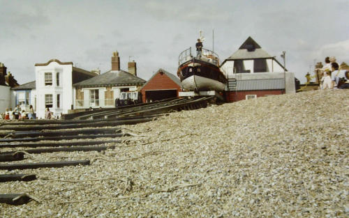
Stretching south from Lowestoft to the river Stour, the AONB protects heathland, reed beds, salt-marsh and mud-flats, a rich mixture of unique and vulnerable lowland landscapes, all of which are under pressure of change. It is deeply indented by the estuaries of the Blyth, Alde, Deben, Orwell and Stour and bounded by the crumbling cliffs and tidal spits of the low and lonely North Sea coastline, the nearest unspoilt coast to Greater London. This is one of the most important wildlife areas in Britain including three National Nature Reserves, many Sites of Special Scientific Interest and the RSPB’s Minsmere Reserve. The mud-flats and creeks of the AONB's salt-marsh-fringed estuaries contain wildlife wetland sites of national and international importance, many of which are Ramsar sites and proposed Special Areas of Conservation and Special Protection Areas. The low-lying coastal hinterland contains some of England's few remaining areas of ancient open heathland, including the Sandlings whose wild sandy stretches are a vanishing refuge of the nightjar, woodlark, and rare heath butterflies. Characterised by its flowering lanes and colour-washed Suffolk pink cottages, the AONB has retained much of its unchanged character. The AONB, with a population of 23,490, has no large towns but includes medieval market towns such as Aldeburgh. There is an increasing number of resident commuters working in Ipswich, Felixstowe and Lowestoft. The rural economy is based on agriculture and tourism. Visitor activity is centred around Aldeburgh with its major summer arts festival and in small towns and coastal hamlets such as Southwold and Walberswick. The booming popularity of watersports has brought considerable leisure usage to the Stour, Deben, Blyth, Ore and Alde estuaries.Dedham Vale
On the Suffolk-Essex border, this AONB protects an exceptional example of a lowland river valley. Undulating slopes fall gently to the slow-flowing, meandering River Stour and in its hedged water meadows, copses and riverbank willows, the landscape is perhaps the epitome of the farmed English countryside. It has an extraordinary range of different scales and special features giving rise to distinctive landscape characters - rolling fields on the valley slopes, lush and sheltered valley- floor meadows and open marshes and intimate tributary valleys. Its pastoral scenes are world famous as the settings used by the artist Constable, and Flatford Mill and picturesque Dedham retain an unspoilt quality, despite their summer visitor onslaught. The designated area of the AONB stretches upstream from Manningtree to within one mile of Bures. However, the landscape quality of the remainder of the Stour Valley has resulted in its designation as a potential AONB or Special Landscape Area and countryside management takes place within this wider framework. Because much of East Anglia's traditional grasslands have already been drained and ploughed for arable farming, the hedgerows and wildflower meadows of Dedham Vale are among some of England's most precious and vulnerable pastoral landscapes and the countryside is enhanced by narrow lanes and characteristic timber-frame and thatch houses. With a population of under 10,000 this is still essentially a farming area, although the AONB now has a significant and growing proportion of residents commuting to Ipswich, Colchester and London. Tourism is localised, but forms an important part of the economy at Dedham and Flatford, while the River Stour is an important boating and angling water.Gower Peninsula
Chosen for its classic coastline and outstanding natural environment, Gower was the first AONB to be designated. Except for the small, urbanised eastern corner, the entire Gower peninsula is an AONB. Complex geology gives a wide variety of scenery in a relatively small area. It ranges from the south coast's superb carboniferous limestone scenery at Worms Head and Oxwich Bay to the salt-marshes and dune systems in the north. Inland, the most prominent features are the large areas of common, dominated by sandstone heath ridges including the soaring sweep of Cefn Bryn. Secluded valleys have rich deciduous woodland and the traditional agricultural landscape is a patchwork of fields characterised by walls, stone-faced banks and hedgerows. Gower's richly varied natural environment of heath, grassland, fresh and saltwater marsh, dunes and oak woodland, is nationally noted. The AONB has three National Nature Reserves, two Local Nature Reserves and many Sites of Special Scientific Interest. Among the many fine natural habitats are the mud-flats and salt-marsh of the Burry Inlet (a candidate Special Area of Conservation, Special Protection Area and Ramsar site) and the flora-rich limestone grasslands. Gower has been settled since prehistoric times and has a high concentration of ancient sites. The western end of the Peninsula is listed in the Register of Landscapes of Outstanding Historic Interest in Wales for its Neolithic and Bronze Age features and its surviving medieval open field system. Almost all the coast is in the protective ownership of City and Council of Swansea, the National Trust, the Countryside Council for Wales or the Glamorgan Wildlife Trust. Gower is still traditionally farmed with small, mixed arable livestock and dairying enterprises, many exercising ancient commons grazing rights. The area is covered by Tir Cymen agri-environment scheme whereby farmers agree to manage their agriculture for the benefit of conservation, wildlife, access and to help maintain traditional landscapes. With an AONB population of approximately 10,000 the vast majority of the working population of Gower's villages commute to Swansea. The AONB lies entirely within Swansea's boundaries and added to retirement and holiday homes, this dormitory element has considerably altered the area's social balance. Tourism plays a major but highly seasonal part in the rural economy, largely through caravan sites and small-scale guesthouses and B&B. The AONB is both a major water sports and family holiday destination for urban South Wales and the AONB is within four hours travelling time of 18 million people. The public rights of way network is extensive covering 431 km (268 miles) and is heavily used by both visitors and local people as it offers a wide variety of experiences reflecting the diversity of the Peninsula.Wye Valley
Symonds YatThe Wye Valley, winding sinuously down from Hereford to Chepstow, is both one of the finest lowland landscapes in Britain and one of the few lowland AONBs. In the north, the river meanders through the broad meadows, dotted woods and hedgerows of the Hereford plain. Its most dramatic limestone scenery, including the famous Symonds Yat, lies downstream from Ross-on-Wye. Deeply incised meanders have cut into the plateau to form sheer wooded limestone cliffs with superb views down to the valley floor. Between the gorges are broader valley reaches, with rounded hills and bluffs and a gently rolling skyline. In recognition of its immense nature conservation importance, the Wye was the first major river to be designated as a Site of Special Scientific Interest along its entire length. Within the AONB it is renowned both as a refuge of rare species, particularly those of limestone woodlands, and as one of the few remaining areas with comparatively large tracts of ancient broadleaved woodland. The pastures, hay meadows, hedges and copses within the farmed landscape of the AONB are also rich natural habitats. Farming in the AONB still follows a traditional pattern of mixed arable and dairying plus fruit orchards in the fertile north, and is an essential part of the landscape's value. Forestry has been an industry for centuries both here and in the nearby Forest of Dean and the Forestry Commission has substantial landholdings in the AONB. Limestone continues to be actively quarried. Tourism is a major contributor to the rural economy. The AONB includes a number of picturesque riverside settlements such as Ross-on-Wye and Tintern with its medieval abbey. Annually, an estimated two million visitors come to the Wye Valley, which is highly accessible from urban South Wales, Bristol and the Midlands. The Wye is a premier salmon fishing river and a major national focus for canoeing and other water sports. Offa's Dyke National Trail passes through the AONB and the Wye Valley Walk is one of the region’s most heavily used recreational footpath routes.Malvern Hills
The special quality of the Malverns lies in its contrasts. The distinctive, narrow, north-south ridge, a mountain range in miniature, thrusts unexpectedly from the pastoral farmland patchwork of the Severn Vale. The highest point is Worcestershire Beacon (425m) and walkers along the ridge crest enjoy views as far as Wales and the Cotswolds. Within a few square miles, notably varied geology gives the AONB a series of differing landscapes. The ridge, with its high open stretches of semi-natural grassland, owes its hogsback skyline to heavily folded and faulted pre-Cambrian rocks. Sandstones and marls underlie the fertile arable plain to the south-east. To the west, alternate limestone and sandstone beds undulate in pastoral scarps and vales with a pleasing rural pattern of meadows, fields and orchards and a maze of narrow lanes. The geological variety and centuries of traditional farming have given the AONB great ecological value. Herb-rich, unimproved pastures and native woodland support a wealth of habitats, species and wildlife. Also a historical landscape, the ridge is crowned by three ancient hill forts, the most famous being the ditches and ramparts of British Camp. This is an area of pastoral farming, with dairying and stock-rearing, plus fruit growing, mixed crops and forestry. Large areas are grazed as ancient commons. The AONB has a population of approximately 13,000 and villages such as Malvern Wells have experienced considerable growth in their retired population and in workers commuting to Birmingham and Worcester. The towns of Great Malvern and Ledbury fringe the AONB and the rural economy includes light manufacturing and prestige office development together with the important conference and holiday tourism sector. Tourists have flocked here to 'take the waters' since the early 1800s and Great Malvern's formal paths and rides give the nearby slopes the air of a Victorian pleasure garden. The ridge and hillside paths and the commons are traditional Midlands 'day trip' country. The Worcestershire Way footpath is an important new recreation resource in the AONB.Cotswolds
The Cotswold Hills rise gently west from the broad, green meadows of the upper Thames to crest in a dramatic escarpment above the Severn valley and Evesham Vale. Rural England at its most mellow, the landscape draws a unique warmth and richness from the famous stone beauty of its buildings. Jurassic limestone gives the Cotswolds their distinctive character, and an underlying unity in its use as a building material throughout the area. The limestone lies in a sloping plateau with a steep scarp slope in the west drained by short streams in deep cut wooded valleys, and a gentle dip slope which forms the headwaters of the Thames. This gentle slope has a maze of lanes connecting picturesque streamside villages built predominantly from local stone. The Cotswolds are nationally important for their rare limestone grassland habitat and for ancient beechwoods with rich flora. Important grasslands such as Cleeve Hill have survived due to their status as ancient common and a National Nature Reserve protects the finest ancient beech complex. Some Cotswolds plants are so rare that they have specific legal protection under the Wildlife and Countryside Act 1981. Traditionally a landscape formed by sheep grazing, this is now prosperous mixed and arable farming country. The AONB excludes urban areas but includes market towns such as Chipping Campden. Now only the third largest employer, agriculture is outranked by tourism and services. Of the working residents (population about 120,000), 73 per cent commute beyond the AONB to Cheltenham, Bath, Gloucester, Cirencester and elsewhere. There is still active mineral extraction in the AONB. Motorways together with a central location, make the Cotswolds accessible to a huge urban visitor area including Bristol, London and the West Midlands. The AONB, with 'honey pot' villages such as Bourton-on-the-Water, Bibury and Castle Combe, is a national and international tourist destination as well as an important local recreation area. The Cotswold Way National Trail, which runs between Bath and Chipping Campden, and a number of other walking routes extend across the AONB.Chilterns
The familiar beech and bluebell woods of the Chilterns sits on London's doorstep, extending 70 km from the Thames at Goring Gap northeast to Hitchin. The Chilterns' rounded hills are part of the chalk ridge which crosses England from Dorset to Yorkshire. The characteristic scarp slope, indented by combes and cut by a number of gaps, looks out north over the panorama of the Vale of Aylesbury. The dip slope, dissected by steep dry valleys, curves gently down into the London Basin. The heavily wooded character of the Chilterns, based on clay-with-flint deposits, gives way in the north to the open downland of Ivinghoe Beacon and Dunstable Downs. The Chilterns contain an important diversity of habitats ranging from chalk grassland and to the country's most extensive areas of beech woodland, with the finest stretches protected as National Nature Reserves. The landscape contains many prehistoric traces including the great dyke of Grim's Ditch and the ancient Ridgeway and Icknield Way. The AONB boundary skirts urban areas such as Luton and High Wycombe and its many picturesque brick-and-flint villages are prized commuter country. However, commercial forestry and agriculture, ranging from small-scale dairying and horticulture to intensive mixed and cereal farming, remains an important part of the economy. Part-time 'hobby farming' is increasing. In addition to the 100,000 people living within the area, half a million people live within three km (8.5 million within 40 km) of the Chilterns, one of South-East England's major recreation resources. Leisure use is largely informal scenic drives, walking and riding and peak demand puts heavy pressure on viewpoints such as Ivinghoe Beacon. The Ridgeway, a National Trail, runs through the AONB from Ivinghoe Beacon to the River Thames and on into the North Wessex Downs AONB. The Thames Path also passes through the southern part of the AONB.Cornwall
This is a heavily fragmented AONB containing some of Britain's finest coastal scenery, including Land's End and the Lizard peninsula. The north coast landscapes range from famous headlands, such as Tintagel and St Agnes Head, to extensive rolling dunes and the spectacularly folded, Atlantic-fretted cliffs north of Boscastle which are some of the highest in Britain. The south coast has an altogether softer landscape of multi-coloured cliffs, tiny coves and picturesque fishing villages. It is indented by the oak-fringed estuaries of the Fal, Fowey and Helford Rivers. To the west, the Lizard and Land’s End areas have distinctive geological formations. The Lizard’s famous serpentine rock is found in the many reefs and spectacular stacks that emphasise the wild isolated character of the coastline. The granite intrusions around Land’s End have created rocks rich in minerals that have been mined for centuries. The AONB also contains the broad expanse of the Camel Estuary (25 sq km) and inland, the high open sweep of Bodmin Moor (208 sq km), the heath plateau of the Lizard Peninsula and the historic moorland of the Penwith Peninsula. Bodmin is the only extensive upland area in Cornwall and is dominated by granite outcrops with characteristic granite tors and clitter slopes, a wealth of mineral deposits and unusual river profiles. The AONB protects many important natural and historic sites. The Lizard, with its complex geology, is a National Nature Reserve, and the Fal River is one of Europe's best unspoilt examples of a drowned estuary complex. The traditional farmed landscape of small hedged and banked fields is intrinsically part of the AONB's value as are its ancient standing stones and the distinctive ruins of Cornwall's tin mines. 86 per cent of the AONB is in agricultural use for meat and milk production and, in favoured pockets, horticulture. The AONB has few large settlements but includes villages such as St Keverne, Mevagissey and Polperro, now bustling holiday centres, and small towns like St Just. Tourism is a vital part of the rural economy and the AONB is intensively used by visitors to the Cornish resorts. The South West Coast Path, a National Trail, follows the coastline.North Devon Coast
Stretching west and south from Combe Martin to the Cornish border, this is essentially a coastal AONB containing some of the finest cliff scenery in Britain. In the north, steeply dipping rocks form hogsback cliffs in a natural continuation of Exmoor's coastline. Turning south, Hartland Point's dark, sheer crags and razor-like reefs are the coast at its sternest. Facing the full force of the Atlantic, its fractured jagged drama is the stuff of wreckers' tales. The AONB also reaches inland to take in the cliff top plateau around Hartland. This is scored by deep valleys which reach the coast as steep hanging gaps in the cliffs, often foaming with spectacular coastal waterfalls. In contrast, the AONB includes the broad sweep of Barnstaple Bay, the surfing beaches of Westward Ho! and the huge dune systems of Braunton Burrows on the Taw and Torridge Estuary. Although skirting larger resorts such as Ilfracombe, the AONB boundary takes in picturesque fishing hamlets, including tiny 'honey pot' Clovelly. The remote cliffs and cliff-top grasslands are important ecological sites, with many Sites of Special Scientific Interest. The dunes of Braunton Burrows, with their rare flora such as marsh orchids, are a National Nature Reserve. The AONB has approximately 12,000 residents and most live in coastal villages such as Combe Martin and Woolacombe. The coastal hinterland provides rough pasture for sheep farming but tourism is the major local employer. The AONB is heavily used both for traditional family holidays, coach excursions and increasingly for water sports, particularly surfing and windsurfing. The South West Coast Path, a National Trail, has opened up the high cliff tops for walkers and naturalists.South Devon Coast
Stretching from Torbay to the outskirts of Plymouth, the AONB coastline is one of many moods and also a Heritage Coast. It ranges from sheltered hidden coves to the jagged pre-Cambrian cliffs of Bolt Head and from the long golden expanses of Slapton Sands to the cool, tree-shaded serenity of the Dart and Kingsbridge estuaries, some of Britain's finest ria coastline. Inland, the AONB protects the fertile, sheltered South Hams peninsula. This is 'deepest Devon' country, a pastoral landscape of flowering hedgerows and ancient sunken lanes, carved into by the richly wooded valleys of the Avon and Dart. The AONB's built environment of thatched, white, pink and ochre cottages and picturesque fishing ports such as Dartmouth and Salcombe is intrinsic to its quality. The entire AONB coast is county-designated as a coastal preservation area and contains many Sites of Special Scientific Interest. The peninsula provides a haven for one of Britain's widest range of birds and the reed beds and freshwater lakes of Slapton Ley are a notable habitat. Much of the cliff top land has been acquired by the National Trust. At the western end lies the Plymouth Sound and Estuaries proposed Special Area of Conservation. The South Hams is traditional Devon mixed farming country and the rural economy depends on agriculture, tourism and fishing. The AONB’s population of approximately 33,000 is mainly concentrated in larger settlements such as Dartmouth, Wembury and Salcombe. The AONB villages are increasingly popular with commuters working in Torbay and Plymouth. The AONB's coast is the prime day trip destination for nearby resorts such as Brixham, Paignton and Torquay as well as for city dwellers from Plymouth and Exeter, and each summer sees a huge casual visitor influx. Dartmouth and Salcombe are long-established local and holiday sailing centres and the South Devon Coast Path and local network of footpaths are increasingly well-used.Quantock Hills
A narrow, gently curving 19-km ridge, the Quantock Hills run north west from the Vale of Taunton Deane to the Bristol Channel coast. Standing out above the agricultural plain, the ridge looks far more imposing than its actual height of 245 to 275m and is famous for its views that, by repute, stretch over nine counties. For so small an area, the landscape shows immense variety and on its heights, a surprising air of solitude and wildness. Underlying rocks range from the Hangman Grits of the hilltops to undulating shales and the distinctive new red sandstone of the West Country. The steep western scarp is deeply grooved by combes, rising to the hilltop heathland plateau. Eastward, long broad valleys, with an enclosed landscape of copses and hedgerows roll away towards the Somerset Levels. The heathland and sessile oak woodlands of the AONB are nationally important wildlife habitats, notably rich in species. Much of southern Britain's heathland has vanished or survives as fragments, making the AONB's extensive heaths particularly valuable. Native red deer still roam the Quantock Hills. The rural economy is based on mixed farming, dominated by dairying, sheep and beef rearing. A large part of the Quantocks plateau is open common with traditional grazing rights. Forestry and small-scale quarrying are secondary activities. There are no towns in the AONB but a number of attractive red sandstone villages. Tourism is a significant part of the economy, based on farm accommodation and guest houses. The AONB is also a highly popular local recreational area with heavy demand from the towns on its fringe.Mendip Hills
Stretching eastward from the Bristol Channel, the imposing 300-m ridge of the Mendips rises, like a rampart above the Somerset Levels. The landscape's distinctive silver-grey crags, gorges, dry valleys and rock outcrops show unmistakably that this is carboniferous limestone country and in fact, Britain's most southerly example. Sink holes and depressions pockmark the surface and chemical action on the rock has produced spectacular underground caves. The Mendips' most dramatic landscape is in the centre of the AONB, site of the famous Cheddar Gorge and Wookey Hole Caves. The Mendips rise to a high, bare plateau around Priddy and Charterhouse, criss-crossed by drystone walls and rich in archaeological remains. Other areas of the AONB are well-wooded with a prosperous farmland fringe. Several important landscape features help to create the AONB's distinctive character, ranging from dew ponds and drystone walls to the 'gruffy ground' of old mine workings. The AONB, with two National Nature Reserves and many Sites of Special Scientific Interest, contains varied and important natural habitats including limestone pastures, ancient woodland and the gorge cliffs themselves with their rare flora. The Mendip plateau is particularly rich in ancient Bronze, Iron Age, Roman and medieval field monuments. Traditionally this is sheep farming country and the ancient Priddy Sheep Fair still takes place. Dairying is now the major farming activity plus high-investment, mixed farming units and horticulture on the fertile southern fringe. Forestry Commission plantations and limestone quarries are in operation in the AONB. Its main settlements are in the villages at the foot of the plateau, many of them now commuter territory for nearby Wells and Weston Super Mare. Tourism, in village and farmhouse B&B and caravan sites, makes a significant contribution to the area's economy. A national destination for coach excursions and day trips, the AONB is also a leading caving centre and a popular local riding area.Tamar Valley
Rising on the borders of Cornwall and Devon, the rivers Tamar, Tavy and Lynher, form one of the last, unspoilt drowned valley river systems in England. On their passage to the broad estuary near Plymouth, the rivers flow through a series of deep meanders, steep gorges and wooded valleys. A ribbon of woodland extends along the Estuary margin although it is often no more than a mature hedgerow above a steep earth bank. In the middle valleys where the ridges are wide the high land has an almost plateau character and there is a feeling of remoteness and solitude. The landscape contains a wide variety of wildlife habitats, including many ancient woodlands and wetlands that provide important wintering grounds for wildfowl and wading birds. People have lived in the Tamar Valley for centuries, and the diverse scenery reflects the impact of their activities in an area rich in natural resources. Field patterns disclose ancient farming practices, disused mine workings reveal intensive mining activity during the 18th century, and old orchards scattered on the warm, south-facing valley slopes are the remnants of market gardens that were widespread in the area at the beginning of the 20th century.East Devon
This is an AONB protecting some of the most unspoilt holiday coast in Britain, yet it also encompasses a surprisingly untouched rural hinterland. The coastal landscapes, stretching from Lyme Regis to Exmouth, show the lush, highly coloured scenery of classic 'postcard Devon'. Devon red sandstone meets the sea in a coastline of sheer high cliffs, steep wooded combes and coves, its line startlingly broken by the white chalk of Beer Head. Inland, the landscape rises to high, flat and surprisingly remote plateaux, often topped by heathland commons, particularly in the west. In the north it breaks into the hilly country fringing Honiton. The plateau is incised by the north-south flowing rivers Axe, Sid and Otter which wind to the sea through quiet, hedge-bordered meadows. The AONB's estuaries, heaths and cliff top grasslands are important natural habitats and the 'Undercliffs', the spectacular 8 km landslip near Axmouth, are a National Nature Reserve of great geological and wildlife interest. The AONB's headlands and hilltops show many traces of prehistoric settlement. The area's population (approx. 15,000) is spread between small towns and villages, including Budleigh Salterton, once the home of Sir Walter Raleigh. The major occupations are farming and tourism, although fishing is still a way of life in villages such as Beer with its traditional lobster industry. Agriculture is predominantly dairying, but includes sheep, cereals, pigs and poultry. The AONB boundary stops short of, or skirts, the resorts of Lyme Regis, Exmouth, Sidmouth and Seaton but these are the main employment, visitor and residential centres. For generations this coast has been a traditional family holiday destination, and it continues to receive seasonal visitor pressure. The AONB is also increasingly important for informal outdoor recreation, particularly walking, and the South West Coast Path, a National Trail, follows the line of the cliff tops.Blackdown Hills
The Blackdown Hills are a little-known group of hills lying on the border of Devon and Somerset. Broadly, the area extends from Wellington in the north to Honiton in the south and from Cullompton in the west to Chard in the east. The Blackdown Hills are best known for the dramatic, steep, wooded scarp face they present to the north. To the south the land dips away gently as a plateau, deeply dissected by valleys. On top of the plateau there are wide open windswept spaces; in the valleys nestle villages and hamlets surrounded by ancient and intricate patterns of small enclosed fields and a maze of winding high-hedged lanes. As part of the only extensive outcrop of Upper Greensand in the region, the geology of the Blackdown Hills is unique in Britain. Not only giving rise to the area’s distinctive topography, the underlying non-calcareous rock has created a notably diverse pattern of plant communities. The isolated villages and springline farmsteads retain a quiet rustic charm and, using local building material - chertstone, cob and thatch - many of the buildings are of considerable architectural merit with great appeal in their mix of styles. A number of important archaeological sites add richness to the landscape, from high wooded promontories such as the great earthworks of Iron Age Hembury fort to the recently discovered evidence of Roman iron smelting. Above all, however, what makes the Blackdown Hills special is the unspoilt rural character of the ‘ordinary’ landscape. Farming, largely dairying, has retained many traditional practices. The area remains sparsely populated and there are no towns within the AONB.Dorset
Covering some 44 per cent of Dorset, the AONB stretches along one of Britain's finest coastlines and reaching inland, takes in countryside which still evokes the settings of the Hardy novels. Curving through the county to the sea, the dominating chalk ridge of Dorset underpins the AONB's landscape. It stretches in a broad band of downland from the Upper Axe Valley eastwards to the Stour Valley near Blandford Forum. A southern arm circles Dorchester and extends to the Isle of Purbeck. The rural landscape varies from the ridges and valleys of central Dorset, through chalk ridges and limestone plateau to the sandy heaths and flats of Poole Harbour. The AONB's coast, including the famous Lulworth Cove and the great pebble barrier bank of Chesil Beach, is as notable for its complex chalk, limestone and sandstone geology and rich ecology as for its scenery. The rare remaining downland and heathland are also highly important conservation habitats supporting a wide range of flora and fauna with notable rarities. The AONB has many Sites of Special Scientific Interest and several National Nature Reserves. The particular quality of the Purbeck Heritage Coast has been recognised by the award of the Council of Europe's Diploma for the Conservation of Protected Landscapes. Rich in prehistoric sites and field patterns, the AONB contains one the finest Iron Age forts in Europe - Maiden Castle. Agriculture is the major land user, including mixed arable, dairying with beef and sheep grazing. Mineral-rich Purbeck is the site of extensive oil, gas, limestone and brick industries. Skirting major centres, the AONB includes picturesque market towns and ports such as Beaminster and Bridport. The AONB population of 90,000 continues to grow through in-migration of commuters and the retired. The coastal stretch of the AONB is a highly popular tourist area and major resorts such as Weymouth and Swanage attract two million visitors a year. The 956 km South West Coast Path starts at Poole Harbour and the coast's extensive footpath network is well-used by residents and visitors.Cranbourne Chase
Cranborne Chase and West Wiltshire Downs AONB is part of the extensive belt of chalkland which stretches across southern England. It is divided into its two areas by the fertile wooded Vale of Wardour. To the south, Cranborne Chase with its smooth rounded downs, steeply cut combes and dry valleys shows a typical chalk landscape. To the north, the topography of the Wiltshire Downs is more varied and broken, with shapely knolls and whaleback ridges. Both areas are fringed on the west by an impressive scarp, cresting above the adjoining clay vales. Traditional downland pasture is now largely confined to steeper slopes but large rectangular fields emphasise the chalkland's open character. The chalkland valleys of the Wylye, Nadder and Stour are mainly in permanent pasture, with many copses and hedgerows. In the northwest, the AONB's sandstone fringe of wooded ridges and valleys includes rich parklands such as Longleat and Stourhead. The AONB is of great ecological importance. Its protected sites range from ancient downland, herb-rich fen and river meadow to scattered deciduous woodland which includes remnants of the ancient Cranborne Chase hunting forest and the former Royal Forests of Selwood and Gillingham. It is rich in prehistoric sites with many ancient monuments and field patterns on the downs, whilst the Vale of Wardour is dominated by large 18th and 19th century estates, parklands and associated villages. This is a deeply rural area with scattered villages and narrow roads. Agriculture, both pastoral and mixed, is the major employer together with commercial forestry and limited mineral extraction. There are no large settlements in the AONB but nearby country towns such as Salisbury, Shaftesbury and Warminster are growth areas. The AONB is not a developed tourist area as yet, although demand for caravan sites, holiday and second homes is increasing.North Wessex Downs
The evocative, albeit made-up, name for the AONB was created to give a protective coherence to one of the largest tracts of chalk downland in southern England and perhaps one of the least affected by development. The name comes from the kingdom of the West Saxons in Britain, said to have been founded by Cerdic about AD 500, covering present-day Hampshire, Dorset, Wiltshire, Berkshire, Somerset, and Devon. In 829 Egbert established West Saxon supremacy over all England. The AONB includes the bright, bare uplands of the Marlborough, Berkshire and North Hampshire Downs and sweeps on its western edge to a crest above the White Horse Vale. In the east, the AONB's chalk ridge meets the Thames and the Chilterns AONB along the wooded reaches of Goring Gap. It loops south round the Kennet Valley, with superb views north from the steep scarp edge, to fall gently away to the Test Valley. The AONB's richly farmed valley landscapes are a pleasing foil to the chalk uplands. They include the Vale of Pewsey's meadows and the handsome beech avenues and oak-fringed glades of Savernake Forest. The importance of the surviving downland habitat and ancient woodland is matched in this AONB by its huge archaeological significance. Settled since 3000 BC, the downs are dotted with barrows and other prehistoric features. The Wansdyke earthwork, Roman roads and ancient tracks such as the Ridgeway add to a striking sense of antiquity. In places, distinctive white horses have been cut into the chalk, the most famous being the White Horse of Uffington. The neolithic stone circle at Avebury and surrounding monuments are included in a World Heritage Site. Agriculture is the major land use in the AONB. Most of the downland sheep runs have been ploughed up for cereals and the valleys are among some of Britain's most fertile farmland. Bordered by the growing towns of Swindon, Reading, Basingstoke and Andover, the AONB's scattering of small towns and villages is inevitably becoming expensive commuter country. Tourism in the AONB has to date been focused on localised sites such as Avebury. However, the AONB is of growing recreational importance both to visitors and to an expanding regional population. A number of initiatives, including the Ridgeway National Trail, and Kennet and Avon Canal Projects have developed to meet this need.Isle of Wight
Half of this beautiful island is protected as an AONB in separate areas which include the principal landscape features of the interior's central and southern downlands and also much of its famous coastline. Visually, the AONB is dominated by chalk in the sharp upfold which forms both the island's eastwest backbone and southern expanse of wide green downs, and its most famous landmark, the bright white stacks of the Needles. On the north coast, the AONB protects the low clay cliffs, salt-marsh and mud-flats of the Hamstead Heritage Coast. In the south, the complex landscapes bounded by the Tennyson Heritage Coast range from sandy bays to high unstable sandstone and chalk cliffs, cut by wooded 'chines'. This complexity gives rise to chalk downland, arable farmland, wooded dairy pasture, small areas of heathland and hay meadows, sea cliffs and creeks. The AONB landscape is of considerable scientific and ecological importance and includes exceptional flora-rich chalk grasslands, the north coast's major estuarial habitats and the geologically notable southern cliffs and landslips. A rural island, 80 per cent of its land area is devoted to agriculture with sheep rearing on the downs and heath 'rangelands' and dairying on the lower-lying land, together with pockets of arable farming and forestry. Farming in the north retains its traditional pattern of woodlands, fields and hedgerows, a contrast with the open grazed uplands. The AONB, with a population of 10,000, has few large settlements. It includes small resorts such as Freshwater Bay but skirts major resorts such as Shanklin, Ventnor and Cowes which are major centres of employment, in tourism and services. The Isle of Wight is one of Britain's longest established visitor destinations and includes seaside family resorts, caravan and holiday parks and the seasonal day trip influx on the Solent ferries. The island is also a popular yachting centre, focused on Cowes and Yarmouth. To encourage countryside tourism, the council has created the Isle of Wight coastal footpath and seven long-distance trails.Chichester Harbour
Not only one of the few remaining undeveloped coastal areas in Southern England, but rarer still, Chichester Harbour remains relatively wild. Its bright wide expanses and intricate creeks are at the same time a major wildlife haven and among some of Britain's most popular boating waters. Backed by the South Downs, the harbour is a series of tidal inlets, with a narrow mouth to the sea, punctuating areas of fertile farmland. Fringed by a narrow margin of wind-sculptured oaks and hawthorn, the fields in turn give way to salt-marsh and intertidal mud-lands, broken by a maze of creeks and rithes. Not dramatic in the upland sense, the AONB's landscape nevertheless has a special sense of wilderness and isolation. Its rich diversity is enhanced by the patterns of sea and land changing with the tides and the seasons. In this flat landscape, the vertical elements of church spires and old mills are an important part of its character, as are the colour-washed, red-roofed villages. The AONB's massive stretch of tidal flats and saltings are of outstanding ecological significance. The rich, complex estuarine habitats of the harbour are a Ramsar designated wetland. Very large populations of wildfowl and waders use the mudflats feeding on the rich plant life and the huge populations of intertidal invertebrates. More than 9,000 Brent geese overwinter on the intertidal mud-land and adjacent farmland. There are no towns in the AONB, although it is easily accessible from Portsmouth and Southampton. Picturesque creekside villages such as Bosham and Itchenor are sought after for commuter, retirement and holiday homes. The harbour lowlands contain high quality arable farmland with some beef and dairy farming. Boatyards, marinas and commercial fishing are important elements of the local economy. This is one of the south coast's most popular sailing waters with as many as 10,000 craft regularly using the harbour, but with 14 yacht and sailing clubs and seven training centres the area is considered to have reached capacity. The villages, sea walls and footpaths of the AONB are a popular local leisure area and day visitor destination for London and the South East.Surrey Hills
Spanning Surrey from east to west, the much-loved, much-used hills of this 'front line' AONB are a beleaguered green expanse which, together with the Green Belt, hold back London's advancing commuter sprawl. The AONB links together a chain of varied upland landscapes including the North Downs, traditionally the day trip destination for southeast London. Rising near Guildford as the narrow Hog's Back, the ridge of the downs stretches away to the Kent border, an unmistakable chalk landscape of swelling hills and beech-wooded combes with a steep scarp crest looking south to the Weald. The downs are paralleled to the south by an undulating wooded greensand ridge, rising at Leith Hill to southeast England's highest point (294m). In the west, sandy open heathland, typified by Frensham Common, stretches away to the Hampshire border. The AONB's fine deciduous woodlands have considerable ecological importance as do the AONB's surviving stretches of chalk grassland and unimproved heath. Including as it does, showpiece villages such as Shere and Abinger, the AONB's built environment is an intrinsic part of its quality. Unlike almost all other AONBs, farming, cereals, mixed and horticulture, is a minority occupier of the land. Increasingly, holdings are bought up by non-farmers and worked part-time or used for paddocks. Being within easy reach of London and skirting major centres such as Guildford, Epsom, Sutton and Reigate, the AONB's economy is inevitably commuter based, with the addition of small-scale craft industry. The AONB is hugely popular with visitors. It includes within its borders such famous beauty spots as Box Hill and the Devil's Punch Bowl. Much of the downland crest is owned by conservation bodies including the National Trust and there is a dense, heavily used network of public and recreational footpaths including the Greensand Way and the North Downs Way National Trail which runs from Farnham across the AONB and into Kent.High Weald
The term 'Weald' is given to the area between the North and South Downs which are the outer chalk rims of the ancient Wealden anticline. The sandstones and clays of the exposed centre of the dome, the 'High Weald' give rise to a hilly, broken and remote country of ridges and valleys. In contrast, open areas of the AONB include Ashdown Forest and, to the east, the river valleys of the Rother, Brede and Tillingham. The AONB meets the coast at Hastings. A close patchwork of small fields, hedges and woodland patterns the rolling landscape which is characterised by its distinctive brick, tile and white weatherboard houses, its oasthouses and also by the traces of the ancient Wealden iron industry including traditional hammer ponds. The dense forest which gave the Weald its name has largely vanished, but fine ancient broadleaved woodland is still abundant, particularly in the deep ghylls which incise the ridges. The Weald retains one of the highest levels of woodland cover in the country at over 23 per cent. Other important habitats include the rare lowland heath of Ashdown Forest and unimproved grassland. Agriculture is central to the rural economy and includes dairying, mixed farming and horticulture. Forestry remains a traditional Wealden industry. There are no major settlements but the major growth of urban areas such as Tunbridge Wells, Crawley, Horsham and London has resulted in a high proportion of commuter population in the AONB villages. The AONB is an important visitor destination for the South East and local authority policy encourages appropriate development of tourism and recreation.Kent Downs
The AONB forms the eastern end of a great arc of designated landscape stretching from the East Hampshire and Surrey Hills AONBs. The Kent Downs AONB continues from the Surrey border in a widening ribbon of rolling countryside to meet the sea at the cliffs of Dover. Inland, the Downs rise to over 240m, cresting in a prominent escarpment above the Weald to the south. It is traversed by the three prominent river valleys of the Darent, Medway and Stour. The AONB roughly follows the southeast's outcrop of chalk and greensand, the two ridges running parallel with each other to the coast. The chalk ridge, with its characteristic dip slope and dry valleys, has great wildlife importance in its unimproved chalk grassland, scrub communities and broadleaved woodlands. The well-wooded greensand ridge is particularly prominent in the Sevenoaks and Tonbridge and Malling districts and supports heathlands and acidic woodlands. Other distinctive landscape elements include the fast disappearing traditional Kentish orchards and hop gardens and the rich wooded foreground of the upland ridges, together with many fine historic parklands including Knole and Winston Churchill's Chartwell. The AONB's ancient settlements include picturesque half-timbered Charing and Chilham on the old Pilgrims Way to Canterbury. Since prehistory, this has been the invasion gateway to England and the North Downs are noted for their archaeological remains and military legacy. A prosperous farming area, its highgrade land is in intense agricultural and horticultural use. The AONB, bordered by large and expanding urban areas including Ashford, Maidstone and the Medway towns, as well as the ports of Dover and Folkestone, has a large commuter population and the North Downs are a heavily used local recreational resource. The area also receives visitor traffic from London and the Kent resorts, and the AONB forms an integral part of tourist promotion of the 'Garden of England'. The North Downs Way National Trail runs along the length of the escarpment and loops up to Canterbury.Isles of Scilly
The Scilly Isles are an archipelago off the southwestern tip of Cornwall, England. One of the islands, St Agnes, is the most southerly point in Britain, being over four miles further south than the most southerly point of the British mainland at Lizard Point. The population of the islands is around 2,200 but this increases in the summer as the Island are a popular holiday destination. Scilly forms part of the ceremonial county of Cornwall, and some services are combined with those of Cornwall. However, since 1890, the islands have had a separate local authority. Since the passing of the Isles of Scilly Order 1930, this authority has had the status of a county council and today is known as the Council of the Isles of Scilly. There are around 140 islands in the Scillies but only five are inhabited and many are underwater at high tide. Due to the North Atlantic Current they rarely have frost or snow, which allows local farmers to grow flowers well ahead of those in mainland Britain. Designated an AONB in 1975 the islands are popular with birdwatchers as they attract rare species not normally seen elsewhere in the UK. Tourists can visit by air or sea from Penzance in Cornwall.



















Areas of Outstanding Natural Beauty
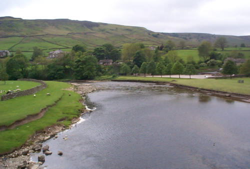
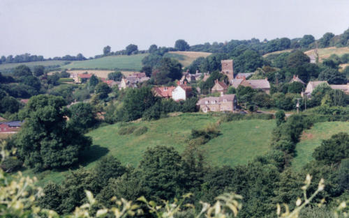
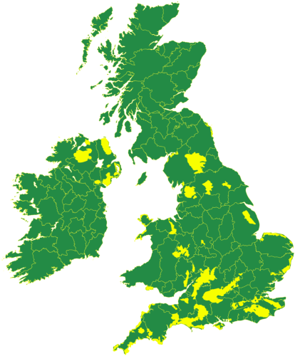
Areas of Outstanding Natural Beauty (AONB) have been described as the jewels of the English landscape. Covering about 15% of England. The smallest is the Isles of Scilly, a mere 16 sq km (designated in 1976). The largest is the rolling hills and valleys of the Cotswolds, totalling 2,038 sq km (first designated in 1966 and later extended).












 Pubs
Pubs Open Map in New Window
 England
 Scotland
 Wales
Wales Ireland
 County Map
 About Britain
 Pubs
Pubs British Beer
 Perfect Pint
 Beer Glasses
 The Barren Years
 Real Fires
 Breweries
 Brewing
 British Food
 Recipes
 Pub Interiors
 Dog Friendly
 Pub Games
 Strange Pub Names
 Visitor Information
 Oldest Pub
 Pub Signs
 Micropubs
 Buildings
 Cathedrals
 Stately Homes
 Castles
 Listed Buildings
 Scheduled Monuments
 Oak Framing
 Architecture
 Thatching
 Waterways
 Sailing
 Shipbuilding
 Boatbuilding
  Shipping Forecast
 Britain's Coastline
 Coastal Locations
 Piers
Piers Lighthouses
 Harbours
 Beach Safety
 British Beaches
 Canals
 Rivers
 Islands
 Lakes
Lakes Waterfalls
 Historical
 Famous People
 Kings & Queens
 Kings of England
 History of Britain
 Industrial Revolution
 Act of Union
 Beaufort Scale
 British Firsts
 World Heritage Sites
 Historical Periods
 Historical Boundaries
 Tradition & Culture
 Morris Dancing
 Film & Television
 Television
 Calendar of Events
 British Sport
 Scottish Highlands
 Money
Money Dry Stone Walling
 British Wildlife
 Class System
 Geographical
 Pub Boundaries
 Facts 'n' Figures
 British Isles
 Other Areas
 Place Name Origins
 Topography
 Suggest an Inn
 Explanation of symbols
 Why Us?
 Places to Visit
 Long Distance Paths
 National Parks
 Areas of Outstanding Natural Beauty
 Coastal Locations
 Other areas of Britain
 Maps
Maps Our Favourite Locations
 Search
 Focus On...
 News
News Contact
 About Us
 Our History
 Donate