Footpaths
Bridleways
Byways
Only walkers are allowed on Footpaths, Bridleways also allow cyclists and horses. Byways add vehicles to the list. All of the
major long distance paths have been walked or cycled either in part or all of the way by some of the Fat Badgers. Other Fat
Badgers have walked or cycled some of the way or all of the way to the nearest pub.
One of the Fat Badgers has travelled the whole of the British Mainland
Coastline - But that was in a car.
There are thirteen long distance routes in England & Wales which have
been designated by the Countryside Agency as 'Official' National Trails
Official National Trail. Ten of these are fully developed and three are still
under development in places. The first National trail was the 412 km
Pennine Way, opened in 1965. The longest is the Southwest Coastal
Path which follows the coastline around the South West of England from
Somerset in the North to Dorset in the South.
The ultimate long distance route is from John 'O' Groats at the North Eastern
tip of Scotland to Land's End at the South Western tip of England. Many people have walked it more than
once to raise money for charity, some have even walked it backwards (that's walking backwards - NOT Land's End to John 'O' Groats !)


Major Paths
Other Paths

1. The West Highland Way
95 miles (153 km) from Milngavie near Glasgow to North of Fort William. Some of the most spectacular scenery in Britain. Scottish mountains, Lochs and Moorland. The West Highland Way goes to the foot of Britain's highest mountain, Ben Nevis, following the shores of Scotland largest loch, Loch Lomond. It is a superb walk through some of Scotland finest scenery of both the Lowlands and Highlands, providing walking that is in parts pleasant and relaxing, in parts strenuous and rough.2. The Pennine Way
Britain's first designated Long Distance Path stretching for 256 miles (412 km) from Edale in Derbyshire along the Pennine mountain chain, finishing at Kirk Yetholm on the Scottish Border. Hill, mountain and moorland scenery is occasionally broken up with an inn perched on the path. Notable parts of the path include Kinder Scout in Derbyshire 2,088 ft, Cross Fell in Cumbria 2,930 ft, Pen-y-Ghent in the Yorkshire Dales, the fantastic Tan Hill Inn and Wishields Crag in Northumberland where the path crosses Hadrian's Wall3. Coast to Coast
The Coast to Coast walk is a popular route for those raising money for charities. 190 miles (306 km) across the Lake District, Yorkshire Dales and North York Moors covering spectacular mountain and moorland scenery. Those that have walked the full length, recommend walking West to East to take advantage of prevailing winds.4. The Dales Way
Running from Ilkley in West Yorkshire across 81 miles (130 km) of delightful riverside and valley scenery to Bowness-on-Windermere in Cumbria through the Yorkshire Dales national Park.5. Offa's Dyke
168 miles (270 km) of varying scenery from valleys to moorland and mountains following the Welsh border with England, passing through the Brecon Beacons National Park. Offa's Dyke is a defensive earthwork dyke along the Welsh border, of which there are remains from the mouth of the River Dee to that of the River Severn. It was built about AD 785 by King Offa of Mercia, England, and represents the boundary secured by his wars with Wales. The dyke covered a distance of 240 km / 149 miles, of which 130 km / 81 miles are still standing. It consists of a large rampart and ditch, the latter usually on the Welsh side, and was laid out to take advantage of natural physical features.6. Pembrokeshire Coastal Path
The Pembrokeshire Coastal Path follows 186 miles (229 km) of superb clifftop scenery through the Pembrokeshire National Park from Amroth in Carmarthen Bay, Dyfed to St. Dogmaels, Cardigan also in Dyfed.7. Peddars Way
Peddars Way and the Norfolk Coastal Path total 94 miles (151 km) of flat lowland walking from Thetford in Norfolk to Cromer on the Norfolk Coast8. Icknield Way
Major pre-Roman trackway traversing Southeast England. It runs from Wells-next-the-Sea on the Norfolk coast in a generally southwesterly direction, passing first through Cambridgeshire and Hertfordshire. This part of the path is also known as Peddars Way. The Icknield Way then runs through Luton in Bedfordshire, skirts the Chiltern Hills, crosses the River Thames at Goring and follows the line of the Berkshire Downs to the source of the River Kennet in Wiltshire. The latter part is also known as The Ridgeway. Especially in the 18th and 19th centuries, the Icknield Way was used as a drove road, to move sheep from their grazing lands in the Chilterns to markets in East Anglia, particularly Newmarket. The central part of the route between Thetford in Norfolk to Ivinghoe Beacon in Buckinghamshire covers 105 miles (168 km)9. The Ridgeway
Grassy track dating from prehistoric times that runs along the Berkshire Downs in South England from Avebury in Wiltshire to Ivinghoe Beacon in Buckinghamshire. The Path covers 85 miles (137 km) of Berkshire, Oxfordshire and the Chiltern Hills.10. The Thames Path
The Thames rises at Kemble, near Cirencester in the Cotswold Hills and the Thames Path follows a course of 213 miles (341km) to the Nore, where it flows into the North Sea. At Gravesend, the head of the estuary, the Thames has a width of 0.6 miles / 1 km gradually increasing to 10 miles / 16 km at the Nore. Lying some 3 miles / 5km Southwest of the Nore is the mouth of the Medway estuary, at the head of which lie Chatham with important naval dockyards, Gillingham, and Rochester. Gravesend on the south bank of the river, some 25 miles / 40 km from the Nore, developed at a point where vessels used to await the turn of the tide. Tidal waters reach Teddington, 62 miles / 100 km from its mouth, where the first lock from the sea (except for the tidal lock at Richmond) is located. There are in all 47 locks, St John's Lock, Lechlade, being nearest the source.11. North Downs Way
Line of chalk hills in Southeast England. They face the South Downs across the Weald of Kent and Sussex and are much used for sheep pasture. The downs run from Andover (on the edge of Salisbury Plain) in the west to the cliffs of South Foreland in the east. The North Downs Way, 141 miles (227 km) which runs along the crest of the North Downs, coinciding in places with the Pilgrims' Way (an ancient track running from Winchester to Canterbury). The Surrey Hills and the Kent Downs are both designated areas of outstanding natural beauty, and at Wye and Crundale Downs there is a national nature reserve. The rivers Stour, Medway, Darent, Mole, and Wey cut through the chalk creating natural routes and important centres, as at Guildford, Reigate, Maidstone, Ashford, and Canterbury.12. South Downs Way
Line of chalk hills in Southeast England, running from near Petersfield, Hampshire, across Sussex to the south coast at Beachy Head near Eastbourne. They face the North Downs across the Weald and are used as sheep pasture. The South Downs Way traverses the area for 106 miles (171 km) from Winchester in Hampshire to Eastbourne in East Sussex. In the west of the range Butser Hill, the highest point, rises to 271 m / 887 ft and Duncton Down to 255 m / 836 ft; in the east Ditchling Beacon rises to 248 m / 813 ft. The rivers Cuckmere, Ouse, Adur, and Arun cut transversely through the chalk, and there are towns at the crossing points such as Lewes and Arundle.13. Isle of Wight Coastal Path
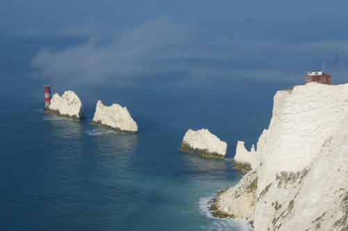
Chalk cliffs, downs and deep ravines, known locally as ‘chines’ are all part of the Isle of Wight Coastal Path. The route circles the entire island on a 65 mile (105 km) footpath. The highest point on the island is St Boniface Down (240 m / 787 ft), where the path passes close by at Bonchurch. The Needles, a group of pointed chalk rocks up to 30 m / 100 ft high in the sea to the west offers great views. The Solent, the sea channel between Hampshire and the island (including the anchorage of Spithead opposite Portsmouth, used for naval reviews) covers approximately half of the distance. Cowes, venue of Regatta Week and headquarters of the Royal Yacht Squadron is on the Northern Coast opposite Southampton Water.14. Southwest Coastal Path
Starting at Minehead in Somerset, the Southwest Coastal Path covers 600 miles (965 km) of spectacular coastal scenery around the West Country peninsular ending at Poole Harbour in Dorset. The route hugs the coastline through Somerset, North Devon, Cornwall, South Devon and finally into Dorset. It rises up to 800 ft Castle Rock in Devon and passes through Exmoor National Park and the wonderful coastal villages of Lynton, Ilfracombe, Bude, Boscastle, Tintagel, Padstow, Newquay, St.Ives, Penzance, Falmouth, St.Austell, Looe, Salcombe, Lyme Regis, Weymouth and Swanage.15. Wolds Way & Cleveland Way
The Wolds Way begins at Hessle Haven, in the shadow of the Humber Bridge. It winds its way through 79 miles (128 km) of chalk countryside, which runs first north from the Humber and then east, to terminate in the 400ft cliffs of Bempton, finishing at the dramatic outcrop of Filey Brigg. The path continues Northwards, becoming the Cleveland Way. 109 miles (176km) long, it follows the coastline past Robin Hood's Bay and Whitby and then continues virtually around the border of the North York Moors National Park boundary and ends at the delightful market town of Helmsley in North Yorkshire.16. Cotswold Way
The Cotswold Way is the jewel in the crown of the Cotswolds. This path follows the escarpment of the Cotswold hills, it is generally easy but with some steep climbs. Highest points can be exposed. The route offers a variety of scenery, from hill top viewpoints to valley woodlands, through villages and farmland. This National Trail was approved in 1998 and work is currently under way to bring the trail up to National Trail standard, prior to its official opening. 102 miles (163km) Starting at Bath and finishing at Chipping Camden, Gloucestershire.17. Hadrian's Wall Path
Hadrian's Wall - 73 miles (117 km) The Hadrian Wall, named after and built by the Roman emperor Hadrianus (AD 76-138) to protect the northern border of the Roman Empire from North British tribes, extends 73 m from Wallsend, near Newcastle upon Tyne, to Bowness on the Solway Firth. Only about 10 m of the original wall are still standing, although earthworks make it possible to trace the route for many miles.18. Pennine Bridleway
The Pennine Bridleway. No steep gradients, no stiles, mostly on tracks with a mix of surfaces including some grassy sections. Suitable for mountain bikes not touring cycles. Some exposed terrain on the northern section. Horses, riders and cyclists need to be fit to complete the whole route in one journey. Work is currently in progress to develop the route. The southern section, to North Yorkshire will open by 2002 and the rest of the Trail by 2003. Consultation is underway on a proposal for a northern extension, which would take the route through Cumbria into Northumberland, ending at Byrness in the Kielder Forest Park, just south of the Scottish Border. 206 miles (330km) Starting at Carsington Reservoir or Middleton Top, Derbyshire, finishing at Fat Lamb Inn, Kirkby Stephen, Cumbria.



Avon Valley Walk - 34 miles (55 km)
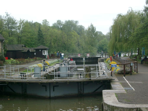
The Avon Valley Path was the idea of a group of walkers from the Ringwood and Fordingbridge Footpath Society and is a walk which totals 34 miles from Salisbury Cathedral in Wiltshire to Christchurch Priory in Dorset.Calderdale Way - 50 miles (80 km)
The southern Pennines, with many interesting old villages and industrial remains, provide the background for this route around the Calder Valley with Bridgehouse at one end, Todmorden at the other and Halifax in between.Cheshire Ring Canal Walk - 97 miles (156 km)
Following the towpaths of six canals, starting at Marple, this is a walk of contrasts. The countryside along the Macclesfield Canal is relaxing after Manchester city bustle; historic buildings give way to modern factories, and all is bordered by the Peak District mountains and Cheshire Plains.Downs Link - 30 miles (48 km)
Linking the South Downs and North Downs Way, this route takes the walker along some of Southern England's most scenic hills and valleys.Essex Way - 81 miles (130 km)
A London underground ride to Epping takes the walker to the start of the Essex Way, which passes through farmland to the Constable country of Dedham Vale, ending at the port of HarwichGlyndwr's Way - 120 miles (195 km)
The Glyndwr's Way offers a scenic route through the hilly countryside of mid-Wales. The route links with the Offa's Dyke Path at Knighton and further north at Welshpool but takes a slightly different route, which takes it as far west as the market town of Machynlleth. The Way is set against the scenery in which Owain Glyndwr fought the English in the 15th century.Heart of England Way - 100 miles (161 km)
Linking the Staffordshire Way at Cannock with the Cotswold Way at Chipping Campden, this route passes through lowland farming countryside before climbing the Cotswold escarpment.Limestone Way - 26 miles (42 km)
This pleasant walk covers the White Peak area, the limestone southern part of the Peak District. Starting at Matlock it follows a course through dry dales to end in Castleton in the more rugged Black Peak area of the National Park.Mawddach Way - 32 miles (50 km)
The Mawddach Estuary is a beautiful and largely unspoilt gem hidden away at the southern end of the Snowdonia National Park. The Mawddach Way is a 50km walk which uses existing footpaths and permissive paths to makes a circuit of the hills either side of the estuary, passing through woodland, pasture and open country. The route, which starts and ends in Barmouth, covers a total distance of 49.8 km, climbing a total of 2226 m along the wayMonarch's Way - 609 miles (981 km)
The escape of Charles II after the Battle of Worcester in 1651. For six exciting weeks, and hotly pursued by the Parliamentary forces under Oliver Cromwell, he travelled first north, then south through the Cotswolds and the Mendips to the South Coast, and finally along the South Downs to Shoreham where he made his escape to France. The Monarch's Way follows the same route taking the walker to many historical buildings, features of interest and antiquity.Oxfordshire Way - 65 miles (105 km)
Starting at the picturesque village of Bourton-on-the-Water, this route links the Cotswolds with the Chiltern Hills, ending at Henley-on-Thames. The path meets the Ridgeway on the Chiltern escarpment.Ribble Way - 72 miles (115 km)
The Ribble Way takes you through the wide flood planes of the Ribble Estuary near Preston, through gentle river pastures from Ribchester to Salway, and the splendid gorge west of Gisburn. The way ends up in the Pennines of North Yorkshire near the source of the river.River Parrett Trail - 80 km (50 m)
This is comfortable walking through the gentle hills of the Dorset and Somerset borders and across the wetlands of the Somerset Levels and Moors. It is also a fascinating journey through orchards, woods, withy beds and the watery haunts of birds and fishermen; passing limestone cottages, Georgian terraces, elegant mediaeval churches and the elaborate pattern of rhynes and water courses of the low land.Robin Hood Way - 88 miles (141 km)
From Nottingham Castle to Sherwood Forest, this route passes many places associated with Robin Hood and visits country parks such as Clumber and Rufford Abbey.Saints Way - 26 miles (42 km)
A Cornish walk between Padstow on the Camel Estuary and Fowey on the south coast, the Saints Way follows a Bronze Age trading route. Later used by Celtic saints to reach scattered farm and moorland communities, seceral relicts of such times can still be seen.Saxon Shore Way - 134 miles (230 km)
This route follows the Kent coast from Gravesend southwards, passing through four Roman forts and many other historical remains, until it reaches Rye, a charming historic town in Sussex.Severn Way - 66 miles (105 km)
A walk along the eastern banks of the River Severn, starting at Tewkesbury. This route passes near the historical Gloucester Docks, Frampton Village and Wick Court. Then alongside the Gloucester-Sharpness Canal to Sharpness Port and Berkley Power Station.Solent Way - 60 miles (97 km)
Starting at Milford on Sea this walk crosses coastal marshes then passes the New Forest, Bucklers Hard and Beaulieu to arrive at Hythe. The ferry takes the walker to Southampton. The route then follows the Solent shoreline over the river Hamble and, via the Gosport Ferry, to Portsmouth and Southsea. Historical waterfront gives way to coastal marshes and quays at Langstone Harbour before the Path ends at Emsworth.Southern Upland Way - 212 miles (341 km)
The Southern Upland Way runs coast to coast from Portpatrick on the south-west coast of Scotland to Cockburnspath on the North Sea coast. Passing through a varied landscape of pastoral valleys, forests and rugged uplands, in an area steeped in Scottish history and tradition, the Way offers a unique experience for walkers. It is a big route in every way, with some demanding stretches through remote hill country. Walkers tackling should be well-equipped and experienced.Speyside Way - 42 miles (68 km)
Starting at the Spey Bay on the Moray Firth the Speyside Way follows the river valley southwards along riverside tracks and quiet country lanes to Craigellachie in Morayshire. From here, the Way follows the former Strathspey railway line to Ballindalloch, close by the confluence of the Spey and the River Avon. The latter river flowing from its source at Loch Avon high in the Cairngorm Mountains. From Ballindalloch the route runs out over the shoulder of Ben Rinnes to Glenlivet (the famous Glenlivet whisky!) and then to Tomintoul, one of the highest villages in Scotland.St Cuthbert’s Way - 63 miles (100 km)
St. Cuthbert's Way is a new long-distance path established in 1996. It extends from Melrose in the Scottish borders to the island of Lindisfarne just off the coast of Northumberland in north-east England, linking places associated with St Cuthbert. It includes a variety of delightful and quite unspoilt countryside: the Tweed valley (origin of the famous woollen cloth), the Eildon Hills, the Cheviot Hills (origin of one of the most famous breeds of sheep), and the Northumberland coast with its broad horizons, sandy beaches, and dramatic contrasts between high and low tide.St Davids Walk - 250 miles (400 km)
A walk from St Davids Cathedral at the South west tip of Wales to Bangor Cathedral in Gwynedd, North Wales. It visits the best coastal scenery and the best mountain scenery in Wales, offering a unique opportunity to see both the Pembrokeshire National Park and the Snowdonia National Park in one walk.Staffordshire Way - 95 miles (153 km)
Completed in 1983, The Staffordshire Way starts in the North of the County at Mow Cop on the rugged Congleton Edge, passing Rudyard Lake along the Churnet Valley to Uttoxeter. It then crosses the Cannock Chase and then onto Kinver Edge in the South of the county. Starting among rugged gritstone hills on the edge of the Peak District, the Staffordshire Way runs South of Leek, the towpath of the restored Caldon Canal takes the walker through the most secluded part of the Churnet Valley and along hilltop paths with views of Staffordshire Rhineland. In mid-Staffordshire, the Way explores the heart of Cannock Chase, a designated Area of Outstanding Natural Beauty. Beyond, the Way passes by the landscaped parklands of Weston, Chillington, Patshull and Enville; the results of 18th century genius which have earned this area the name of "Parkland Staffordshire". The area abounds with reminders of Domesday, Mediaeval England and tales of deeds of chivalry. The climax of the route is a lofty sandstone ridge at Kinver. The Staffordshire Way is also an important link in the regional long distance path network. It connects with the Herefordshire and Worcestershire at Kinver Edge and with the Heart of England Way at Cannock Chase. In north Staffordshire, the Staffordshire Way joins with Cheshire County Council's Gritstone Trail which follows the western edge of the Pennines to Lyme Park - only 10 miles from the start of the Pennine Way at Edale.Suffolk Coast Path - 50 miles (80 km)
Starting at Felixstowe it follows the Suffolk coastline northwards, a Heritage Coast, through marshes, along beaches and small villages like Aldeburgh, former home to the composer Benjamin Britten. The Path ends at Lowestoft near the Broads.Tarka Trail - 180 miles (290 km)
Tarka the Otter, the classic novel by Henry Williamson is taken as the starting point of the walk. The walker is introduced to Tarka Country, with Barnstable on the rivers Taw and Torridge as a central point. The route takes the walker through moorland, wooded valleys and along rugged cliffs on coastal stretches.Trans Pennine Trail - 215 miles (325 km)
Using almost forgotten towpaths, abandoned railroad tracks, and public rights of way the Trans Pennine Trail runs from the Humberside, across middle England to the Merseyside. Routes linking York, Leeds and Sheffield are on there way.Two Moors Way - 102 miles (164km)
89 miles long, stretches from Ivybridge in South Devon, to Lynmouth on the Bristol Channel, passing through some spectacular countryside. The path passes through both the Dartmoor National Park and the Exmoor National Park. The scenery comprises an interesting variety of: high access land - moorland, low access land dotted with gorse, farmland, steep river valleys, slow meandering river valleys, ancient settlements and attractive villages. Most people who walk or run the Two Moors Way break their journey into 6 sections. The Two Moors Way comprises a mixture of easy walking and difficult moorland walking, and in inclement weather can be very challenging. It is easy to lose one's way atop Dartmoor even in good weather.Wayfarer's Walk - 70 miles (113 km)
Through Hampshire's rolling countryside from Emsworth along the Solent Coast, the Wayfarer's Walk goes north over Portsdown and through Meon Valley, then past Watership Down to finish at Inkpen Beacon, near Newbury in Berkshire.Wealdway - 80 miles (129 km)
From Gravesend in Kent to Eastbourne in East Sussex the Wealdway provides fine views of the surrounding countryside and connects with a number of other routes: North Downs and South Downs Way and the Saxon Shore Way.Weavers Way - 56 miles (90 km)
This route links the Norfolk Coast Path at Cromer with Great Yarmouth, passing through or near some of the Norfolk Broads, as well as interesting villages and towns like Felbrigg, Blickling, Aylsham and Stalham.West Mendip Way - 30 miles (48 km)
A route following the western edge of the Mendips, between Wells and Uphill. The walk from Wells Cathedral passes hill-side villages, Wookey Hole Cave, Cheddar Gorge and Shipham then crosses Crook Peak and Bladon Hill to reach the Bristol Channel.Wychavon Way - 41 miles (66 km)
From the Cotswold Way at Winchcombe, an ancient Saxon town, this route leads to Bredon Hill and on through the Worcestershire countryside.Wye Valley Walk - 107 miles (172 km)
Following the River Wye upstream from Chepstow to Hay-on-Wye this walk passes limestone cliffs to reach Tintern Abbey ruins, then climbs to Kymin viewpoint, passes Monmouth and reaches Symonds Yat Rock. The meandering river route passes Goodrich Castle and Ross-on-Wye to reach the city of Hereford. It takes the walker further north through Hay-on-Wye, famous for its second hand bookstores, to end in Rhayader, a typical Welsh market town.



Can I leave my Camper
Van in your Car Park ?


There are many Long Distance Paths that cross the British Isles, most of which pass through National Parks or Areas of Outstanding
Natural Beauty (AONB). National Trails are marked with arrows and an acorn symbol or a thistle in Scotland. Different coloured arrows
denote the type of trail:
Long Distance Paths














 Pubs
Pubs Open Map in New Window
 England
 Scotland
 Wales
Wales Ireland
 County Map
 About Britain
 Pubs
Pubs British Beer
 Perfect Pint
 Beer Glasses
 The Barren Years
 Real Fires
 Breweries
 Brewing
 British Food
 Recipes
 Pub Interiors
 Dog Friendly
 Pub Games
 Strange Pub Names
 Visitor Information
 Oldest Pub
 Pub Signs
 Micropubs
 Buildings
 Cathedrals
 Stately Homes
 Castles
 Listed Buildings
 Scheduled Monuments
 Oak Framing
 Architecture
 Thatching
 Waterways
 Sailing
 Shipbuilding
 Boatbuilding
  Shipping Forecast
 Britain's Coastline
 Coastal Locations
 Piers
Piers Lighthouses
 Harbours
 Beach Safety
 British Beaches
 Canals
 Rivers
 Islands
 Lakes
Lakes Waterfalls
 Historical
 Famous People
 Kings & Queens
 Kings of England
 History of Britain
 Industrial Revolution
 Act of Union
 Beaufort Scale
 British Firsts
 World Heritage Sites
 Historical Periods
 Historical Boundaries
 Tradition & Culture
 Morris Dancing
 Film & Television
 Television
 Calendar of Events
 British Sport
 Scottish Highlands
 Money
Money Dry Stone Walling
 British Wildlife
 Class System
 Geographical
 Pub Boundaries
 Facts 'n' Figures
 British Isles
 Other Areas
 Place Name Origins
 Topography
 Suggest an Inn
 Explanation of symbols
 Why Us?
 Places to Visit
 Long Distance Paths
 National Parks
 Areas of Outstanding Natural Beauty
 Coastal Locations
 Other areas of Britain
 Maps
Maps Our Favourite Locations
 Search
 Focus On...
 News
News Contact
 About Us
 Our History
 Donate