Where inns listed on the Fat Badgers guide are close to a
Lake, Reservoir or Loch, we award a 'ships wheel' symbol.
Whether it be on boats, fishing or simply lazing on a lakeside quaffing a
pint of ale, the Lakes and Lochs of Britain are some of the most scenic
and restful places to be.
Lakes are a body of still water lying in depressed ground without direct
communication with the sea. Lakes are common in formerly glaciated
regions, along the courses of slow rivers, and in low land near the sea.
The main classifications are by origin: glacial lakes, formed by glacial
scouring such as those in the Lake District and the Scottish Lochs;
barrier lakes, formed by landslides and glacial moraines; crater lakes,
found in volcanoes; and tectonic lakes, occurring in natural fissures.
Elan Valley
The Elan Valley Reservoirs are a chain of man-made lakes created from damming the Elan and Claerwen rivers within the Elan Valley in Mid Wales. The reservoirs, which were built by the Birmingham Corporation Water Department, provide clean drinking water for Birmingham in the West Midlands of England. The five lakes are known as the Claerwen, Craig-goch, Pen-y-garreg, Garreg-ddu, and Caban-coch. Water from the reservoirs is carried by gravity to Frankley Reservoir in Birmingham via the Elan aqueduct. Pumping is not required because the network drops 52 metres (171 ft) along its 73-mile (117 km) length from its source to Frankley. A gradient of 1:2,300 maintains a flow of less than 2 miles per hour (3.2 km/h); water takes one and a half to two days to reach Birmingham. The aqueduct, which was started in 1896 and opened in 1906, crosses several valleys and features numerous brick tunnels, pipelines, and valve houses. Work to build the Elan Valley reservoirs was undertaken because the rapid growth of the industrial city of Birmingham in the late 19th century had led to a lack of available clean water. Numerous outbreaks of disease prompted Birmingham City Council to petition the British government which passed the Birmingham Corporation Water Act in 1892. It allowed the corporation to acquire by compulsory purchase all the land within the water catchment area of the Elan Valleys. Thousands of navvies (workers) and their families lived in the purpose-built Elan Village during the construction of the first four dams at the turn of the 20th century. In 1952, the Claerwen dam was opened by Elizabeth II in one of her first official engagements as monarch. Drinking water from the Elan Valley is noted for being exceptionally soft, contrasting with water from local supplies in the West Midlands, not served by the Elan aqueduct, which are noted for hardness. The reservoirs are now owned and managed by Dŵr Cymru Welsh Water. The water filtration works further down the valley is run by Severn Trent Water.Loch Awe
Loch in Argyll and Bute unitary authority, Scotland. The loch, lying 36 m / 118 ft above sea level, is 37 km / 23 miles long (the longest in Scotland) and reaches a depth of 100 m / 328 ft. Fed in the north-east by the rivers Orchy and Strae, it empties to the north-west into the River Awe. Hydroelectricity is generated above the loch at the Cruachan Dam. Kilchurn Castle, a stronghold of the Campbell clan with a keep dating from 1440, stands on a peninsula which is transformed into an island by high tide.Bassenthwaite
Lake on the River Derwent, Cumbria, England. Bassenthwaite is some 6 km / 4 miles long, and lies west of the peak of Skiddaw (931 m / 3,054 ft) on the northern edge of the Lake District.Llyn Brianne
Striking reservoir in Mid Wales, known for both its engineering scale and its rugged, almost wild surroundings. Despite looking ancient and natural, it’s actually a relatively modern creation. Built in the late 1960s - early 1970s as part of a water supply project. The Llyn Brianne Dam (completed in 1972) is the UK’s tallest dam, standing about 91 m (300 ft) high. The dam is of rock-fill construction with a concrete spillway. Designed to regulate the flow of the River Tywi (Towy), ensuring a steady supply of water to South Wales (including Swansea and Llanelli). The reservoir itself holds over 60 billion litres of water. Despite being man-made, it has a very “remote” Highland-like atmosphere, which attracts walkers, cyclists, and photographers. It’s a popular spot for stargazing, thanks to the lack of light pollution (part of the Cambrian Mountains Dark Sky Park).Buttermere
Lake in the Cumbrian Lake District, England, south-west of Keswick; length 2 km / 1.2 miles. It is adjacent to Crummock Water, with which it once formed part of a much larger, single lake; they are now divided by a strip of alluvial deposits. The village of Buttermere lies on the northeastern shore of the lake. On the western side of Buttermere lake there are several mountains: High Crag, High Stile, and Red Pike; on the northwestern side the Sour Milk Gill waterfall flows down from Bleaberry Tarn.Coniston Water
Lake in the Cumbrian Lake District, England. It has a length of 8 km / 5 miles and a width of 1 km / 0.6 mi, which makes it one of the smaller lakes in the area. The village of Coniston (population 1,200; 1991) lies 14 km / 9 miles west of Bowness, between the lake and Coniston Old Man, which is 802 m / 2631 ft high. Donald Campbell died while attempting to improve his world water-speed record on Coniston Water in 1967. Peel Island, one of three small islands on the lake, is the `Wild Cat Island’ of Arthur Ransome's novel Swallows and Amazons (1931). Brantwood, once the home of John Ruskin, stands above the eastern shore of Coniston Water; Ruskin is buried in Coniston churchyard.Crummock Water
Lake in Cumbria, in the north-west of the English Lake District; 4 km / 2 miles long and 1 km / 0.6 miles wide. Crummock Water is separated from Buttermere to the south-east by an area of marshland. The lake belongs to the National Trust.Derwent Water
Lake in Cumbria, England, part of the Lake District. Derwent Water stretches for 5 km / 3 miles south of Keswick into Borrowdale. Derwent Water was part of the area forming the core of the National Trust when it was founded. Derwent Water's especially attractive surroundings prompted Canon Rawnsley, Vicar of Crosthwaite, Keswick, and others to found the Trust in 1895, in order to make such areas of natural beauty accessible to all. The Ruskin memorial on Friar's Crag at Keswick was given to the Trust in 1900.Loch Doon
Lake in south-west Scotland, 5 km / 3 miles south of Dalmellington, forming part of the border between East Ayrshire and Dumfries and Galloway unitary authorities. It lies nearly 210 m / 689 ft above sea-level, and covers an area 10 km / 6 miles long and 2 km / 1 miles wide. The loch, dotted with several small islands, is enclosed by mountains, and contains salmon and trout. Its surplus waters have been diverted south to the River Ken to augment supply to the Galloway hydroelectric scheme.Loch Duich
Loch Duich is a striking sea loch on the west coast of the Scottish Highlands, in the county of Ross and Cromarty (near the Isle of Skye). It’s one of the most picturesque lochs in Scotland, famous both for its natural beauty and the iconic castle that sits at its meeting point with two other lochs. Loch Duich is a sea loch (a saltwater inlet) that stretches inland from the Sound of Sleat. At its seaward end, it meets Loch Long and Loch Alsh - together forming a dramatic three-loch junction. Perhaps the most famous feature of Loch Duich is Eilean Donan Castle, which sits on a small tidal island where the three lochs meet. The castle has roots in the 13th century and is one of the most photographed places in Scotland. It was destroyed during the Jacobite rising of 1719 and rebuilt in the 20th century.Loch Fyne
Sea-inlet in Argyll and Bute unitary authority, Scotland, extending about 65 km / 40 miles north and north-east from the Sound of Bute between the Kintyre peninsula and Argyll on the west and the Cowal peninsula on the east. It reaches a maximum depth of 200 m / 656 ft. Inverary stands on its western shore, about 14 km / 9 miles from the head of the loch. Further south, the fishing port of Tarbert is renowned for its herring catches.Loch Garry
Freshwater loch (lake) in the Scottish Highlands, and it’s known for its striking resemblance - when viewed from a certain point on the A87 road - to the outline of a map of Scotland. This “Scotland-shaped loch” has become a popular stopping spot for travellers heading towards the Isle of Skye. Loch Garry lies in Inverness-shire, along the route from Invergarry to Kyle of Lochalsh. It sits within Glen Garry, which follows the River Garry. The loch is fed by rivers and streams flowing down from the surrounding hills and empties into the River Garry, which eventually joins Loch Oich in the Great Glen. Today, Loch Garry forms part of the hydroelectric power schemes developed in the mid-20th century. The damming altered its water levels, but the distinctive outline has been maintained.Grasmere
English lake and village in the Lake District, Cumbria, associated with many writers. William Wordsworth and his sister Dorothy lived at Dove Cottage (now a museum) 1799-1808, Thomas de Quincey later made his home in the same house, and both Samuel Coleridge and Wordsworth are buried in the churchyard of St Oswald's.Haweswater
Lake on the eastern fringe of the Lake District in Cumbria, England; length 4 km / 2.5 miles. Haweswater lies 22 km / 14 miles north of Kendal, and is situated in less spectacular scenery than other lakes in the region. It acts a reservoir for Manchester, to which it is linked by an aqueduct 130 km / 81 miles long. The village of Mardale was abandoned when Haweswater was enlarged into a reservoir, and now lies beneath the surface of the lake.Loch Katrine
Lake in Stirling unitary authority, Scotland, 8 km / 5 miles east of Loch Lomond and 15 km / 9 miles west of Callander. The loch extends over a distance of 13 km / 8 miles and its width is less than 2 km / 1 miles at its widest point. Loch Katrine is situated in the heart of the Trossachs area, noted for its magnificent scenery. Its waters discharge through the lochs of Achray and Vennachar into Eas Gobhain, which flows east for approximately 3 km / 2 miles and then joins Garbh Uisg to form the River Teith, and supply the city of Glasgow. Ellen's Isle is located on the lake, and the mountains of Ben Venue and Ben A'an rise either side of its outflow.Kielder Water
Large man-made reservoir located in Northumberland, North East England. It's the largest artificial lake in the UK by capacity, holding 200 billion litres of water, and spans over 250 square miles of forest, lake, and open moorland. The reservoir was created to support the UK's industrial economy by providing a water supply, but its purpose has shifted over time to focus on conservation and recreation. Kielder Water & Forest Park is known for its dark skies, making it an ideal spot for stargazing and astronomy.Loch Leven
Lake in Perth and Kinross, Scotland; area 16 sq km / 6 sq miles. The river Leven flows from Loch Leven. It has six islands; Mary Queen of Scots was imprisoned on Castle Island until she escaped in 1568. The whole loch has been a National Nature Reserve since 1964. The loch is known for its trout fisheries. St Serf's, the largest island in the loch, contains the ruins of an old priory.Loch Linnhe
Sea-inlet on the west coast of Scotland, 56 km / 35 miles long and 2-8 km / 1-5 miles wide, forming part of the border between Highland, and Argyll and Bute unitary authorities. Fort William stands at the head of the loch , at the junction with Loch Eil and the beginning of the Caledonian Canal system. Its waters are divided by the Corran Narrows, with Loch Leven entering the lower half. The island of Lismore lies within the mouth of Loch Linnhe as it joins the Firth of Lorn.Loch Lochy
Lake in Highland unitary authority, Scotland, covering an area 16 km / 10 miles long and 1 km / 0.6 miles wide. It forms part of the Caledonian Canal system, linked to Loch Oich by Laggan Locks.Loch Lomond
Largest inland stretch of water in Great Britain by surface area, and one of Scotland’s most famous lochs - celebrated for its beauty, history, and cultural importance. Located about 20 miles (32 km) north-west of Glasgow, straddling the boundary between the Lowlands and the Highlands. Around 22 miles (36 km) long, up to 5 miles (8 km) wide, and dotted with over 30 islands (such as Inchmurrin, the largest freshwater island in the British Isles). Part of Loch Lomond and The Trossachs National Park (Scotland’s first national park, created in 2002). Historically, the loch was a route between Highland clans and Lowland towns. The islands have been settled for centuries - Inchcailloch (“Island of the Old Woman”) has ancient graves and a ruined church. The Highland Boundary Fault runs right through the loch - meaning the scenery shifts dramatically: • The southern part is broad, with gentle, wooded hills. • The northern part is narrow, fjord-like, with steep mountains rising from the water (Ben Lomond, at 974 m / 3,196 ft, towers over the eastern shore).Loch Loyne
Loch Loyne is a freshwater loch in the Scottish Highlands, not far from Invergarry, lying between Loch Cluanie and Loch Garry. Unlike natural lochs such as Loch Duich, Loch Loyne today is largely a man-made reservoir created in the mid-20th century. There was originally a much smaller natural loch in the valley but in the 1950s, the North of Scotland Hydro- Electric Board built a dam across the River Loyne as part of a wider hydroelectric scheme. Before the flooding, the old Invergarry to Skye road (an early 19th-century military road built by Thomas Telford) ran through the valley. During very dry summers, the remains of the drowned road can still reappear above the waterline - an eerie sight. The loch lies between the hills of Gleann Garry and Glen Loyne, making it a quiet, wild area compared to more touristy lochs.Llyn Llydaw
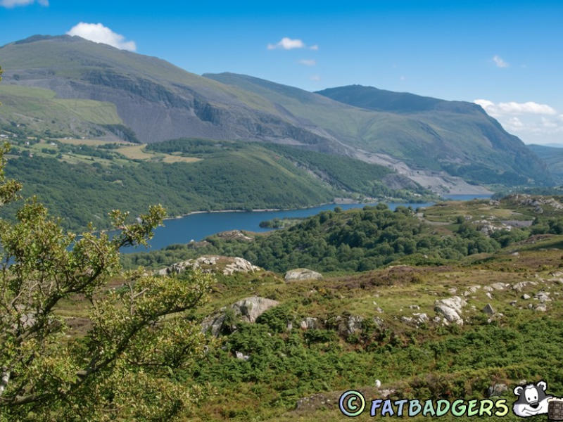
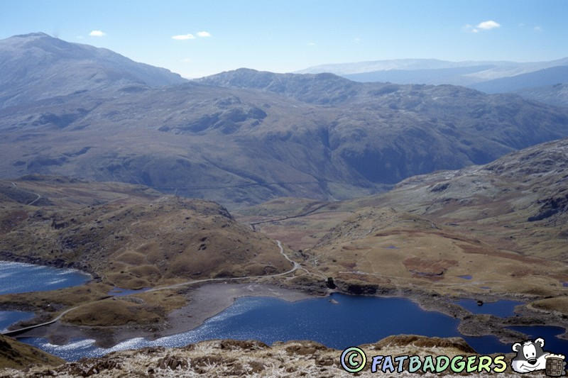
Striking glacial lake located on Snowdon (Yr Wyddfa), the highest mountain in Wales, in Snowdonia National Park. It’s one of the most famous lakes in the region due to its dramatic mountain setting and historical significance. Llyn Llydaw sits at an altitude of about 436 meters (1,430 ft) above sea level on the Snowdon Massif. It’s roughly 1 km long and lies along the path of the popular Llanberis Path to the summit of Snowdon. This view is from the Pyg Track looking at the lake with the Miner’s Track passing through. The lake is fed by mountain streams and drains into the Afon Glaslyn, which flows down to the valley below. In the 19th century, the lake was modified as part of a hydroelectric scheme to provide power for the Ffestiniog and Welsh Highland Railways, and later for slate quarries in the area. The lake is part of the Snowdonia National Park SSSI due to its upland habitats.Loch Morar
Lake on the west coast of Highland unitary authority, Scotland, extending 19 km / 12 miles in length, with an outflow across a narrow bridge of land to the Sound of Sleat, 5 km / 3 miles south of Mallaig. It is the deepest loch in the British Isles, reaching a maximum depth of 310 m / 1,017 ft.Loch Ness
Lake in the Highland unitary authority, Scotland, extending north-east to south-west. Forming part of the Caledonian Canal, it is 36 km / 22.5 miles long, 2 km / 1 miles wide (on average), 229 m / 754 ft deep, and is the greatest expanse of fresh water in Europe. There have been unconfirmed reports of a Loch Ness monster since the 15th century. Loch Ness, Loch Lochy and Loch Oich are connected by the Caledonian Canal, and together provide the only navigable channel between the east and west coasts of Scotland.Llyn Padarn
Sometimes written as Llyn Padam is a glacially formed lake in Snowdonia (Eryri), North Wales, and one of the most scenic bodies of water in the region. Located near the village of Llanberis, at the foot of Snowdon (Yr Wyddfa), it’s about 2 miles (3 km) long, making it one of the largest natural lakes in Wales. Connected to the smaller Llyn Peris, with the town of Llanberis nestled between them. The lake sits at the heart of the slate quarrying area of Llanberis, once one of the world’s most important slate-producing regions. It is home to the rare Arctic charr, a fish species left behind from the Ice Age. The surrounding woodlands and waters are part of a Site of Special Scientific Interest (SSSI).Loch Rannoch
Lake in Perth and Kinross unitary authority, Scotland, lying 204 m / 669 ft above sea level, and extending over an area 15 km / 9 miles long and about 2 km / 1 miles wide. The River Tummel, a tributary of the River Tay, flows through the loch from west to east.Rydal Water
Small lake in Cumbria, England, between Ambleside and Grasmere, situated beside the road from Ambleside to Keswick. From 1817 until his death in 1850, the poet William Wordsworth made his home nearby at Rydal Mount in Rydal village.Loch Shiel
Narrow lake in south-west Highland unitary authority, Scotland, extending 27 km / 17 miles in length, and widening to less than 1 km / 0.6 miles. It marked the boundary between the former counties of Inverness and Argyll. A monument stands at Glenfinnan, at the head of the loch, marking the place where Prince Charles Edward Stuart raised his standard on 19 August 1745 in his bid for the throne.Talybont Reservoir
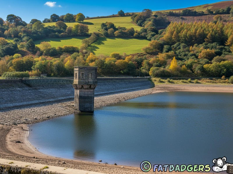
The largest stillwater reservoir in the Brecon Beacons (Bannau Brycheiniog) National Park, South Wales, and it combines striking mountain scenery with an interesting history. Built in the 1930s to supply water to Newport and surrounding areas. A large concrete dam was constructed across the Caerfanell Valley and today, it’s still an active water supply reservoir managed by Welsh Water (Dŵr Cymru). Lies north of the village of Talybont-on-Usk, nestled in the central Brecon Beacons and surrounded by wooded hills, with views of higher peaks such as Waun Rydd and Tor y Foel. Fed mainly by the River Caerfanell and local mountain streams. The reservoir has a striking valve tower near the dam, a landmark feature on the water. A network of tunnels and pipes carries water towards Newport, with balancing reservoirs along the way.Thirlmere
Lake in Cumbria, north-west England, in the Lake District national park, 6 km / 4 miles south-east of Keswick. It is 5 km / 3 miles long and 1 km / 0.6 miles wide. Thirlmere is surrounded by forests that were first planted when it became a reservoir for Manchester in 1894. The ridge of Helvellyn lies to the east of the lake.Ullswater
Second largest lake in the Cumbrian Lake District, north-west England, on the east side of Helvellyn ridge; length 13 km / 8 mi, width 1 km / 0.6 miles. The former lead-mining and quarrying villages of Patterdale and Glenridding to the south of the lake now consist mainly of hotels and guesthouses for tourists.Lake Vyrnwy
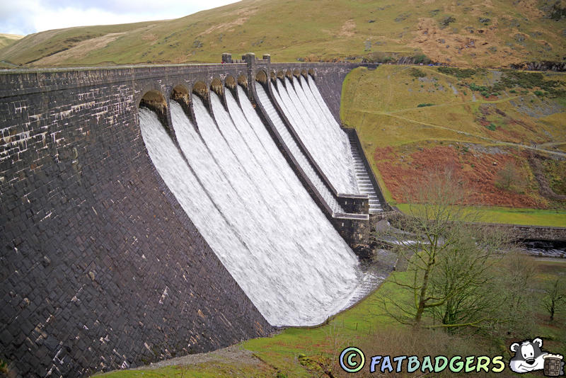
Llyn Efyrnwy in Welsh, a beautiful and historically significant reservoir in Powys, mid-Wales. Created in the 1880’s to supply clean water to the city of Liverpool, about 70 miles away. The valley of the River Vyrnwy was dammed, and the original village of Llanwddyn was flooded beneath the waters. A new village (also called Llanwddyn) was built below the dam to house the displaced residents. Completed in 1888, it was the first large stone-built dam in the UK and built with dressed stone blocks, it’s 44 meters (144 ft) high and 357 meters (1,171 ft) long. The lake is surrounded by forest and moorland, managed in part by the RSPB as a nature reserve, a haven for rare birds such as the peregrine falcon, pied flycatcher, and redstart. The Victorian-era straining tower in the lake looks like a fairy-tale turret, one of the most photographed features.Windermere
Largest lake in England, in the Lake District, Cumbria, north-west England; length 17 km / 10.5 miles; width 1.6 km / 1 miles. Windermere is the principal centre of tourism in the Lake District. The town of the same name extends towards Bowness on the eastern shore of the lake. Wholly in Cumbria since 1974, Windermere was formerly in Westmorland, with its southeastern shore and western shores in Lancashire. The shores are well-wooded, and the lake drains southwards into Morecambe Bay via the River Leven. The town of Windermere developed around the railway station which was built in 1847; combined with Bowness, it is a tourist resort. There is a car ferry service from Bowness across the lake to Sawrey.


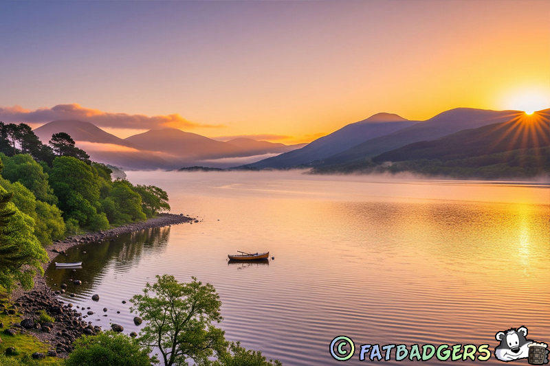


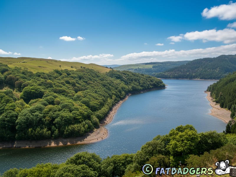






The United Kingdom has a wide variety of freshwater wetlands served by the plethora of rivers and streams that flow through the country. Many of these
rivers flow through lakes, lochs or reservoirs. There are some parts of the British Isles which have more than their fair share such as the Highlands of
Scotland and obviously the Lake District in England. Central Wales has a large number of man made reservoirs which were built to supply the cities of
Liverpool, Manchester and Birmingham with water.
Lakes














 Pubs
Pubs Open Map in New Window
 England
 Scotland
 Wales
Wales Ireland
 County Map
 About Britain
 Pubs
Pubs British Beer
 Perfect Pint
 Beer Glasses
 The Barren Years
 Real Fires
 Breweries
 Brewing
 British Food
 Recipes
 Pub Interiors
 Dog Friendly
 Pub Games
 Strange Pub Names
 Visitor Information
 Oldest Pub
 Pub Signs
 Micropubs
 Buildings
 Cathedrals
 Stately Homes
 Castles
 Listed Buildings
 Scheduled Monuments
 Oak Framing
 Architecture
 Thatching
 Waterways
 Sailing
 Shipbuilding
 Boatbuilding
  Shipping Forecast
 Britain's Coastline
 Coastal Locations
 Piers
Piers Lighthouses
 Harbours
 Beach Safety
 British Beaches
 Canals
 Rivers
 Islands
 Lakes
Lakes Waterfalls
 Historical
 Famous People
 Kings & Queens
 Kings of England
 History of Britain
 Industrial Revolution
 Act of Union
 Beaufort Scale
 British Firsts
 World Heritage Sites
 Historical Periods
 Historical Boundaries
 Tradition & Culture
 Morris Dancing
 Film & Television
 Television
 Calendar of Events
 British Sport
 Scottish Highlands
 Money
Money Dry Stone Walling
 British Wildlife
 Class System
 Geographical
 Pub Boundaries
 Facts 'n' Figures
 British Isles
 Other Areas
 Place Name Origins
 Topography
 Suggest an Inn
 Explanation of symbols
 Why Us?
 Places to Visit
 Long Distance Paths
 National Parks
 Areas of Outstanding Natural Beauty
 Coastal Locations
 Other areas of Britain
 Maps
Maps Our Favourite Locations
 Search
 Focus On...
 News
News Contact
 About Us
 Our History
 Donate