



1.
2.
3.
4.
5.
6.
7.
8.
9.
10.
11.
12.
13.


Brecon Beacons
519 square miles (1,351 sq. km). The impressive ridge of old red sandstone, running from the border to Llandovery, dramatically separates rural mid-Wales from the industrial valleys of the southern coalfield. The set of ridges and valleys which is the Black Mountains in the east contrasts with the tall Beacons at the centre, and the heather-covered Black Mountain at the western end. Limestone ramparts provide a southern edge. Farming has shaped the landscape over the centuries and, today, Welsh cultural traditions are still strong. People have been living in the Brecon Beacons for more that 5,000 years and there is a powerful sense of history evident in the ancient standing stones, cairns and buildings found across the park. The Offa's Dyke Path runs up the eastern boundary. The Flat-topped mountains rising to close on 3000ft (923m). Largely un threatened by development, the valley of the Usk divides the Black Mountains area in the east from the main massif of the Beacons in the middle of the park and the Black Mountain in the west. All three outcrops share the same precipitous sandstone scarps, their severity modified by the sweeping curves of ice-hewn amphitheatres. To the north there are fine views over the Wye Valley and the soft knuckles of the hills that lead down to it.Dartmoor
368 square miles (954 sq. km). The last wilderness of southern England. Tors, clitters, cleaves and combes - Dartmoor names for the granite outcrops, rock litter, gorges and river valleys - add drama to the park and underline its wild aspect, as do the quaking mires and high tussock boggy plateaus ringed by rocky tors. Many remains of ancient man, notably Bronze Age Grimspound. Modern man threatens. Almost the whole of the northern moor is a military training area. Reservoirs and afforestation are changing both uplands and valleys, though a major reservoir scheme at Swincombe was defeated. Farmers increasingly seek to enclose the moor. Tourist traffic clogs the lanes in summer. Heather and grass moorland, with valley woods, support a rich variety of wildlife, as well as the ponies, cattle and sheep of the hill farmers. Dartmoor boasts the densest collection of Bronze Age remains in north west Europe, rich remains of a metal mining industry and the youngest castle in England. There are 33,000 people living in the park in small towns, villages and remote farmsteads. The moor was used as the backdrop for Conan Doyle's thriller - 'The Hound of the Baskervilles' in 1902 and is home to Britain's most remote & secure prison. Places to visit include Castle Drogo, Museum of Dartmoor Life, Okehampton Castle, Buckfast Abbey and Becky Falls.Exmoor
268 square miles (693 sq. km). The tallest sea cliffs in England form the northern boundary of this smallest moorland park. The grass moor of the erstwhile Royal Forest is surrounded by heather-covered hills and wooded combes. The Valley of the upper Exe separates Exmoor proper from the Brendon Hills at the eastern end of the park. Red deer and nightjar at the woodland edge, merlin and ring ousel out on the moor are representatives here of a rich diversity of wildlife. Bronze-Age burials, Roman fortlets, ironworks and medieval castles bear witness to the work of the predecessors of the present day hill farmers who care for this splendid landscape. The South West Coastal Path - a national trail - runs along the northern edge of the park. Bare moorland skylines, plunging combes, huge hogbacked hills tumbling into the Bristol Channel. A wild park of bog and bracken and brawling streams, but vulnerable to change. The superb heather moorland, for the sake of which the park was designated, has shrunk from 60,000 acres (24,240 hectares) just after the war to barely 40,000 acres (16,160 hectares) today, through conversion to more intensive agricultural use rather than traditional sheep grazing.Lake District
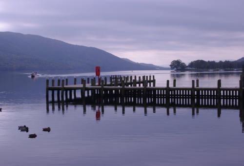
885 square miles (2,292 sq. km). The biggest park and one of the most famous landscapes in the British Isles, unique in it’s mingling of great fells and still waters. Here the Lake poets launched the Romantic Movement and the area has continued to attract writers ever since. Today the main threat to Lakeland's beauty is its own popularity resulting in damage through sheer numbers of visitors. The water authorities continue to cast covetous eyes at the natural lakes. The landscape at the edge of the Lake District National Park is softer and more rounded, in great contrast with the central areas, which are wild, rugged and dramatic. Sixteen lakes are arranged like spokes of a wheel in this heartland. This imposing landscape has rich literary and artistic associations. The area is visited by approximately 12 million people each year and is home to 42,000 people. The 2,896km of public rights of way comprise splendid walking and even climbing - gentle on the lakeside and challenging uphill gradients. Understanding through enjoyment courses are available at Brockhole, on Windermere, and at Blencathra, near Keswick.Northumberland
405 square miles (1,049 sq. km). Hadrian's WallThis remote National Park is border country stretching Fifty miles (80km) of lonely, surging hill country. To the north, England meets Scotland on the long backbone of the Cheviot Hills; in the south, Hadrian's Wall strides along the undulating crests of the Whin Sill ridge. Between those two frontiers are wide expanses of wild, open moorland and dense forest. Contains the heathery Simonside hills and the round-topped Cheviots, bleakly beautiful, deceptively benign, where there are more sheep than people. In the north the Ministry of Defence Redesdale training area bisects the park. Elsewhere afforestation is burying whole hills in conifers. The park is an historic landscape of unrivalled quality. Hadrian's Wall and its associated features form a World Heritage Site. In the Cheviot foothills and the Breamish Valley in particular, settlements and field systems from prehistoric through to medieval to modern times are superimposed, one upon another. The ruins of castles and bastles (fortified farmsteads) also bear witness to the troubled past. The Pennine Way runs the length of the park.North York Moors
553 square miles (1,432 sq. km). The largest expanse of continuous heather moorland in England clothes the plateau top, turning it in late summer into a tablecloth of vivid purple. Dissected by farmed dales, the whole area supports a wealth of wildlife. The eastern boundary is formed by 42km of coastline, where spectacular cliffs separate bays and fishing villages. Red pantile roofs characterise the villages. Stone crosses punctuate the ridges. The cultural heritage is easily explored via the 1,609km of footpaths and bridleways. The main range, the Cleveland Hills, reaching 1490ft (458m) on wild Urra Moor, are flat-topped. The Cleveland Way path follows the northern scarp of these hills, leading eventually to a rugged coast of towering cliffs. For gentler views, the dales, notably Rosedale and Farndale are idyllic. Threats: potash mining near Whitby and loss of moorland to conifers and the plough.Peak District
555 square miles (1,438 sq. km). Britain's first national park, designated in 1951, which has its own financially independent planning board. One third of the population lives within an hour of the park. Each year, over 22 million day visits are made to this unique landscape, distinctive for two quite separate sets of special Geological qualities. In the centre is the beautiful 'White Peak', with its deep limestone dales and undulating fields. To the north, east and west is the dramatic 'Dark Peak' - peat moorlands cut across by edges of precipitous millstone grit, where heather and bracken predominate. Rich in natural and cultural treasures, the Peak District National Park is a place of national and international importance. Wedged between the conurbation’s of Manchester and West Yorkshire and stretching down into Staffordshire and Derbyshire, the park covers the southern section of the Pennine chain of mountains. The scenic Edale, just north of Mam Tor and Winnats Pass, is the starting point of the Penninne Way Long Distance Path.Pembrokeshire Coast
240 square miles (620 sq. km). Britain's only predominantly coastal national park, it is one of the smallest and most densely populated. It also contains one of the largest densities of specially protected sites in Europe. Rugged cliffs and islands, tree-lined estuaries and open moorland are all features of the area. Wild flowers flourish in the mild climate and there are famous seal and sea bird colonies. The park is also steeped in Welsh legends and a complex history. The stunning coastline can be seen at its best from the spectacular coast path, a designated national trail, stretching 299km (186 miles) from north to south. No mountains here. Instead, one incomparable asset - 170 miles (272km) of majestic cliffscape rated among the finest coastlines in Europe despite uncontrolled caravan sites and chalet developments. The cliffs are a paradise for birds - and bird-watchers. Skomer island (also in the park) is a national nature reserve open to the public, home of puffins, razorbills and Manx shearwaters. And like all coasts, it is occaisionally prone to oil pollution, largely due to the oil terminal at Milford Haven.Snowdonia
827 square miles (2,142 sq. km). The magnificent mountain fastness of North Wales, offering rock climbs whose challenge is out of all proportion to their height, lakes, woods, valleys, waterfalls and estuaries complete the picture. Quarries, power stations, afforestation and unsympathetic holiday developments mar parts of the park. The glaciers of the last Ice Age moulded the Snowdonia landscape of deep valleys and rugged mountains. Rivers, lakes and waterfalls, and remnants of ancient deciduous woodlands, are typical of the park, as is the coast, with its sandy bays, dunes and the three beautiful estuaries - Glaslyn/Dwyryd, Mawddach and Dyfi. A rich variety of plants and wildlife mirrors the diversity of the landscape and the whole of the park is a stronghold of the Welsh language and way of life. Archaeological remains from the Neolithic period, the Roman occupation and the Middle Ages survive through to those of the recent industrial past of gold, lead and copper mining, and slate quarrying on a grand scale.Yorkshire Dales
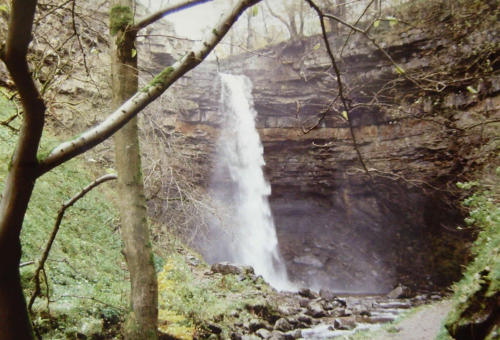
683 square miles (1,769 sq. km). The Yorkshire Dales, sitting astride the central Pennine watershed, has been describe variously as wild, expansive, tranquil and, at times, awesome and bleak. Whatever the mood, the Dales unquestionably occupies the finest area of upland limestone country in Britain and possesses a unique combination of both related and contrasting landscape features. Here is a sympathetic blend of pastoral valleys, delightful waterfalls, heather-covered grit-capped fells, flower-rich hay meadows, intricate patterns of dry-stone walls, field barns and stone villages. Exposed limestone cliffs, gorges, valley-side screes and a fretwork of limestone pavements, scraped clean by glacier ice, add a further dramatic dimension. Historic and Prehistoric remains abound, as do places to stay in each dale. The Pennine Way crosses the park from north to south, offering visitors a choice of two worlds the high and open striding fells, and the glorious dale bottoms with their sparkling becks and grey villages. The most spectacular countryside is the Three Peaks area (Whernside, lngleborough and Pen-y-Ghent). Here quarrying has dug deep for limestone, and afforestation threatens.Norfolk Broads
117 square miles (303 sq. km). The Broads is Britain's largest protected wetland. Its fens, winding waterways, wet woodlands, grazing marshes, 40 broads or shallow lakes, and five rivers provide unique habitat for a huge range of rare species. The best way to see this land is by water aboard a boat. Navigation has always been a crucial part of the Broads economy; formally for the many traders who plied the 200km of waterways and today for the visitors who enjoy the relaxation of a holiday afloat. The Broads Authority looks after the area and its navigation. Its work includes restoring the wetland and promoting sustainable tourism.New Forest
224 square miles (580 sq. km). The forest proper has been protected since 1079AD and is managed by the Forestry Commission for the Crown. Verderers and commoners play a significant role in the management of the ponies and cattle, which roam the forest by ancient right. Plantation and ancient woodlands, surrounded by open heath, given way to small-scale farmland vital to the life of the Forest. The heritage area extends to the Solent coast - an Area of Outstanding Natural Beauty. Bustling villages provide bases for easy exploration of this historic landscape.South Downs
633 square miles (1,641 sq. km). Formerly the East Hampshire and Sussex Downs Areas of Outstanding Natural Beauty, combined in 2010 to become the South Downs. Stretching from Eastbourne in the South East with Birling Gap that everyone with a Windows PC knows well due to it being the default background photo all the way through to ancient Winchester in the North West. The area encompasses the full rolling sweep of chalk downland in East and West Sussex plus an extensive area of the Weald to the north-west. The downs, with their flora-rich remnants of unimproved pasture, are also an important archaeological area. East Hampshire's superb broadleaved woodlands of hanger beech, ash, wych elm and lime form one of the most important of such areas in Britain.










National Parks
National Parks and Areas of Outstanding Natural Beauty cover nearly one fifth of England and Wales. They were created to conserve the countryside and are subject to strict laws concerning development. Many of the countries Long Distance Paths run through the National Parks. If an inn is within a National Park boundary, we award them an icon to show that they are.













 Pubs
Pubs Open Map in New Window
 England
 Scotland
 Wales
Wales Ireland
 County Map
 About Britain
 Pubs
Pubs British Beer
 Perfect Pint
 Beer Glasses
 The Barren Years
 Real Fires
 Breweries
 Brewing
 British Food
 Recipes
 Pub Interiors
 Dog Friendly
 Pub Games
 Strange Pub Names
 Visitor Information
 Oldest Pub
 Pub Signs
 Micropubs
 Buildings
 Cathedrals
 Stately Homes
 Castles
 Listed Buildings
 Scheduled Monuments
 Oak Framing
 Architecture
 Thatching
 Waterways
 Sailing
 Shipbuilding
 Boatbuilding
  Shipping Forecast
 Britain's Coastline
 Coastal Locations
 Piers
Piers Lighthouses
 Harbours
 Beach Safety
 British Beaches
 Canals
 Rivers
 Islands
 Lakes
Lakes Waterfalls
 Historical
 Famous People
 Kings & Queens
 Kings of England
 History of Britain
 Industrial Revolution
 Act of Union
 Beaufort Scale
 British Firsts
 World Heritage Sites
 Historical Periods
 Historical Boundaries
 Tradition & Culture
 Morris Dancing
 Film & Television
 Television
 Calendar of Events
 British Sport
 Scottish Highlands
 Money
Money Dry Stone Walling
 British Wildlife
 Class System
 Geographical
 Pub Boundaries
 Facts 'n' Figures
 British Isles
 Other Areas
 Place Name Origins
 Topography
 Suggest an Inn
 Explanation of symbols
 Why Us?
 Places to Visit
 Long Distance Paths
 National Parks
 Areas of Outstanding Natural Beauty
 Coastal Locations
 Other areas of Britain
 Maps
Maps Our Favourite Locations
 Search
 Focus On...
 News
News Contact
 About Us
 Our History
 Donate