What is the Solent?
The Solent is a tidal strait on England’s south coast, separating the Isle of Wight from Hampshire. It’s one of the UK’s busiest and most ecologically rich waterways, known for shipping, sailing, wildlife and a deep maritime history. It separates the Isle of Wight from mainland Hampshire and connects the English Channel to Southampton Water It’s about 20 miles long, but narrow in places - and that narrowness is what makes it so important. How it was formed Thousands of years ago: The Isle of Wight was part of the mainland, once a prehistoric river valley, later flooded by rising sea levels. The Solent river originally flowed through what is now Wareham in Dorset (now the rivers Piddle and Frome which flow north and south of the town). It flowed through what is now Poole Harbour and south of what is now Bournemouth and Lymington before entering the English Channel between Portsmouth and Bembridge on the Isle of Wight. The chalk cliffs at Old Harry’s Rocks near Swanage were once connected to the Needles Rocks now the most Westerly point of the Isle of Wight. The wider Solent region covers around 600 square miles and includes 241 miles of coastline, stretching from Barton‑on‑Sea to the New Forest and across to the Isle of Wight. Rising sea levels after the last Ice Age flooded the river valleys. What we see today is a drowned landscape - old rivers, forests and settlements now underwater. In fact, submerged prehistoric forests still appear at very low tides. Why it matters The Solent is: • One of Britain’s busiest shipping lanes • A natural defensive barrier • A perfect sheltered anchorage It gave Britain: • Safe access to the Channel • Protection from invasion • A launch point for naval power Naval power & warfare This is where the Solent really earns its reputation. The Mary Rose was King Henry VIII’s beloved Tudor warship, launched in 1511, sunk in battle in 1545, and dramatically raised from the Solent in 1982. Today she’s preserved in Portsmouth, making her one of the most extraordinary archaeological time‑capsules in Britain. • Type: Tudor carrack warship • Built: 1510–1512 in Portsmouth • Commissioned by: Henry VIII • Primary role: Flagship and frontline warship in conflicts with France and Scotland • Sank: 19 July 1545 during the Battle of the Solent • Raised: 1982 after 437 years underwater The wreck tells us everything about Tudor naval life. England had only a small navy when Henry took the throne, so the Mary Rose represented a major step toward building a permanent Royal Navy. She had between 78–91 guns, including early broadside artillery with roughly 415 men (sailors, soldiers, gunners). Cutting‑edge for the early 1500s. Portsmouth Portsmouth Harbour is a large natural inlet on England’s south coast, opening into the Solent. What makes it exceptional: • A very narrow entrance (easy to defend) • Deep, sheltered water inside • Direct access to the English Channel Used by the Romans as a supply point, it expanded seriously after the Norman Conquest. By the 12th century, Portsmouth was a key royal port Kings didn’t choose it by accident — it was close to: • France • Normandy • England’s political heartland In naval terms: almost perfect. From the Tudor period onward, Portsmouth became the Royal Navy’s main base. Henry VIII built England’s first dry dock here (1495) and established permanent dockyards. The harbour is surrounded by layers of defence: • Round Tower and Square Tower (medieval) • Palmerston Forts (Victorian anti-French paranoia) • WWII gun batteries and boom defences During the 18th and 19th centuries ships like HMS Victory were fitted out here, tens of thousands worked in the dockyard. Ropewalks, sail lofts, and foundries dominated the city and later Ironclads, Submarines & Aircraft carriers. It was a major fleet base in World War I and central to D-Day planning during World War II. Today it is still home to much of the modern Royal Navy and operates side by side as a Historic Dockyard home to not only the Mary Rose but also HMS Warrior and HMS Victory. HMS Warrior was Britain’s first iron-hulled, armoured warship. Launched in 1860 and built at Blackwall on the Thames, she was the most powerful warship in the world the day she entered service. HMS Warrior had wrought-iron armour plates backed by teak, guns protected inside an armoured citadel, was too fast to catch and too strong to penetrate. She had around 40 guns including massive 68-pounder smoothbores and early rifled cannon concentrated amidships behind armour. She represented the end of wooden navies, the beginning of industrial warfare at sea and Britain’s determination to stay ahead technologically. France had launched La Gloire in 1859 - Britain’s response was basically: “Fine. We’ll end the argument.” HMS Victory - one of the most important ships ever built and still quietly ruling Portsmouth Harbour. HMS Victory was a first-rate ship of the line, launched in 1765 and built at Chatham Dockyard, she was designed to carry 100–104 guns across three gun decks with crew of around 800–850 men. For over 40 years, she was one of the most powerful warships afloat. She represents the age when battles were decided by: • Wind • Seamanship • Discipline • And terrifying close-range firepower Victory was Nelson’s flagship at The Battle of Trafalgar (1805), she was Nelson’s flagship and fought against the combined French and Spanish fleets. Nelson used an unconventional tactic: attacking perpendicularly to break the enemy line. Victory remained in service until 1812 and later became a harbour flagship. She is moored in Portsmouth Historic Dockyard, still officially HMS Victory (not “ex- Victory”) and serves as the ceremonial flagship of the First Sea Lord. Buckler’s Hard is an 18th‑century shipbuilding village on the Beaulieu River in the New Forest, famous for building several of Nelson’s warships and for its remarkably preserved Georgian layout. Set on the Beaulieu River which flows out into the Solent, with two rows of Georgian cottages leading down to the water, originally part of a 13th‑century monastic estate, later transformed into a shipbuilding centre. Several ships that fought at Trafalgar were built here, including vessels commanded by Nelson. Two rows of 18th‑century brick cottages preserved almost exactly as they were. Forts and defences The Solent is ringed with defences from different eras: • Henry VIII’s Device Forts (Calshot, Hurst, Yarmouth) • Palmerston Forts (Victorian, anti-French panic) • WWII anti-invasion defences The Solent Forts are a chain of four massive Victorian sea fortresses built in the mid‑1800s to defend Portsmouth from a feared French invasion. They sit out in the water between Portsmouth and the Isle of Wight, and today they’re some of the most dramatic military structures in Britain - granite islands built to stop a war that never came. 1. Spitbank Fort • Built: 1861–1878 • Purpose: Protect Portsmouth Dockyard from French attack • Construction: Circular, armour‑plated, granite structure • Later life: Served as a naval installation until 1956; later converted into a luxury hotel; now privately owned • Location: About a mile off Portsmouth Harbour 2. No Man’s Land Fort • Built: c.1860s, part of the same defensive programme • Features: 15‑foot granite walls, heavy armour plating • Cost: £462,500 at the time - an enormous sum • Later life: Royal Navy until the 1980s; then sold and converted into a hotel 3. Horse Sand Fort • Built: Alongside Spitbank and No Man’s Land as part of the Palmerston Forts • Role: Form a defensive line across the eastern Solent • Notes: Similar design - armoured, circular, and built to mount heavy guns 4. St Helens Fort • Built: Same defensive scheme • Location: Near Bembridge, Isle of Wight • Role: Guard the eastern approaches to the Solent The forts can be seen when travelling to the Isle of Wight or setting off on a bigger voyage by cruise liner from Southampton. The fabulous Hovercraft service from Portsmouth to Ryde passes very close to Spitbank Fort and the ferries to the Channel Islands pass between Horse Sand Fort and No Man’s Land Fort. The Isle of Wight The island: • Controls access to the western Solent • Was strategically vital against: o The Spanish o The French o Napoleon o Hitler Charles I was imprisoned on the Isle of Wight before his execution. The island is one of our favourite UK destinations, whether arriving by ferry or yacht, there’s plenty of great places and pubs to visit. Trade, industry, and ports The Solent powered Britain’s economy: • Portsmouth - Royal Navy • Southampton - trade, liners, and later container shipping • Cowes - shipbuilding and yachting It’s also where: • The Titanic sailed from on her final voyage • Troops departed for both World Wars Sailing & culture Today the Solent is: • One of the world’s busiest recreational sailing areas • Home to Cowes Week, one of the oldest sailing regattas • A place where tides, currents, and wind make sailing notoriously tricky Locals will tell you the Solent has a personality - and they’re not wrong. The Solent is one of the busiest and most challenging sailing areas in the world because it combines: • Strong, fast-changing tides • Narrow channels • Heavy commercial traffic • Shifting winds • Lots of very confident sailors It’s a training ground that exposes every weakness you didn’t know you had. Tidal streams can hit 4-5 knots and can run east and west at the same time in different parts. Timing is everything - get it wrong and you go backwards. There’s even a phenomenon called the “double high tide” at Southampton: Water level rises, pauses, rises again caused by the Isle of Wight funnelling water in weird ways. Winds in the Solent are tricky because of the Isle of Wight, mainland hills and headlands like Hurst and Calshot, at Hurst Point where the Solent narrows considerably, with the wind and tide in the wrong direction it can be almost impossible to sail or even motor through with a sailing yacht engine. Lottery winners in gin palace caravans can still get through though, although they tend to restrict themselves to Cowes marina. You’ll also get: Sudden wind shifts, strong gusts near shore and wind shadows behind land. You share water with: • Container ships • Ferries • Naval vessels • Cruise ships • Racing fleets • Weekend sailors • Paddleboarders who look way too relaxed There are also shallow areas which don’t usually affect sailing yachts (apart from Brambles Bank where Cricket is sometimes played at very low spring tides) so big ships cannot stop or turn for you. The technical term “constrained by their draft” means that it’s one of the few times where sailing vessels have to give way to large powered vessels - It’s not open-water sailing - it’s precision sailing! Cowes is the sailing capital of the world with Cowes Week (since 1826), the Round the Island Race, club racing almost every weekend and even casual cruising days often feel like unofficial races. Not only will you see famous yachts and yachts owned by the rich and famous, you will find some great pubs and ale houses. At the far western end of the Solent you will see one of the most dramatic and loaded bits of coastline in southern England. The Needles are a line of chalk sea stacks, originally four until one collapsed in 1764. What’s left are three jagged white pillars and a dangerous reef, they’re part of the same chalk formation as: The White Cliffs of Dover, Old Harry Rocks and The Seven Sisters. The name comes from a needle-shaped rock that no longer exists. At their base is The Needles Lighthouse (1859), built on a rock ledge and now automated. It marks one of the most dangerous tidal passages in the Solent area and before modern navigation, this spot wrecked a lot of ships. It’s where The English Channel, The Solent and tidal streams around the Isle of Wight all collide. Nearby cliffs were used to test: Black Arrow and Black Knight rockets, Britain’s early space programme. These tests helped make Britain the third nation to launch a satellite. The Needles mark the exit of the Solent, a boundary between sheltered water and open sea and a psychological threshold for sailors. The last places to enter harbour before hitting the English Channel are Lymington on the mainland and the delightful Yarmouth on the island. Ecology Despite the traffic: • Salt marshes and mudflats support huge bird populations • Seagrass beds are slowly being restored • It’s a vital ecological corridor Human power and fragile nature sit uncomfortably close here but it’s not unheard of to see dolphins in the water and plenty of sea birds. Newtown Creek Anchorage is a surprisingly quiet area for watching wildlife, if the rest of the Solent is busy, competitive and noisy, Newtown Creek is where it exhales. It is an area of saltmarsh, mudflats, seagrass beds and shallow creeks created from a drowned medieval town. Newtown was once a thriving medieval port granted a charter in the 13th century and important enough to send MPs to Parliament. Why the Solent feels special It’s: • A natural moat protecting southern England • A stage for Tudor ambition and modern warfare • A working sea, not a postcard one The Solent isn’t dramatic like Cornwall or wild like the Hebrides - it’s controlled, strategic and quietly dangerous.


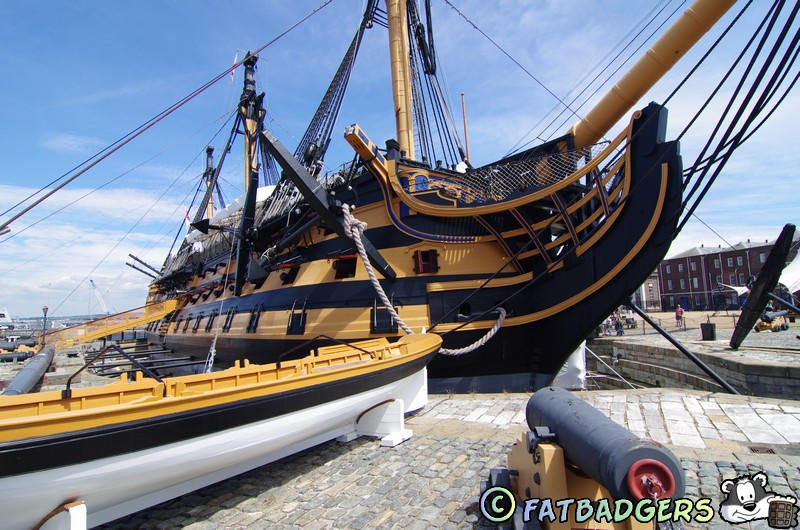


The Solent













The Solent is one of those places where geography, history and power all stack on top of each other. It looks calm on a map, but it’s been absolutely
central to English history for centuries and it’s one of the Fat Badgers favourite places to visit - either on land or by boat.

 Pubs
Pubs Open Map in New Window
 England
 Scotland
 Wales
Wales Ireland
 County Map
 About Britain
 Pubs
Pubs British Beer
 Perfect Pint
 Beer Glasses
 The Barren Years
 Real Fires
 Breweries
 Brewing
 British Food
 Recipes
 Pub Interiors
 Dog Friendly
 Pub Games
 Strange Pub Names
 Visitor Information
 Oldest Pub
 Pub Signs
 Micropubs
 Buildings
 Cathedrals
 Stately Homes
 Castles
 Listed Buildings
 Scheduled Monuments
 Oak Framing
 Architecture
 Thatching
 Waterways
 Sailing
 Shipbuilding
 Boatbuilding
  Shipping Forecast
 Britain's Coastline
 Coastal Locations
 Piers
Piers Lighthouses
 Harbours
 Beach Safety
 British Beaches
 Canals
 Rivers
 Islands
 Lakes
Lakes Waterfalls
 Historical
 Famous People
 Kings & Queens
 Kings of England
 History of Britain
 Industrial Revolution
 Act of Union
 Beaufort Scale
 British Firsts
 World Heritage Sites
 Historical Periods
 Historical Boundaries
 Tradition & Culture
 Morris Dancing
 Film & Television
 Television
 Calendar of Events
 British Sport
 Scottish Highlands
 Money
Money Dry Stone Walling
 British Wildlife
 Class System
 Geographical
 Pub Boundaries
 Facts 'n' Figures
 British Isles
 Other Areas
 Place Name Origins
 Topography
 Suggest an Inn
 Explanation of symbols
 Why Us?
 Places to Visit
 Long Distance Paths
 National Parks
 Areas of Outstanding Natural Beauty
 Coastal Locations
 Other areas of Britain
 Maps
Maps Our Favourite Locations
 Search
 Focus On...
 News
News Contact
 About Us
 Our History
 Donate