Overview
The mountains and hills of Great Britain are among the most important forces shaping the country’s geography, climate, culture, history and regional identity. Although Britain is not a country of extremely high mountains by global standards, its uplands dominate much of the landscape and have profoundly influenced patterns of settlement, agriculture, language, politics and even national mythology. Broadly speaking, Britain can be divided into two major landscape zones: • the lowland south and east • the upland north and west This contrast exists because the oldest and hardest rocks are concentrated in western and northern Britain, while younger, softer sedimentary rocks dominate much of southern and eastern England. The result is a country where mountainous and hilly terrain occupies enormous areas despite Britain’s relatively modest size. As the tectonic plates continue to move, caused by a geological process called post- glacial rebound (also called isostatic adjustment), which began after the last Ice Age ended roughly 11,000 years ago, the south west is slowly sinking into the sea whilst the north west gently rises. The movement is at most 2mm a year, so anybody born today can still expect to paddle in the sea at Margate when they’re ninety years old and still not get their knobly knees wet.Geological Origins
Britain’s mountains are extremely old by world standards. Most formed hundreds of millions of years ago through: • volcanic activity • continental collisions • uplift and erosion • glaciation Unlike young mountain ranges such as the Alps or Himalayas, British mountains have been heavily worn down over geological time. During the Ice Ages, glaciers dramatically reshaped the landscape: • carving valleys • deepening lakes • sharpening ridges • creating U-shaped glens Many of Britain’s most famous landscapes are therefore glacial in origin.The Scottish Highlands
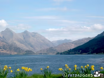
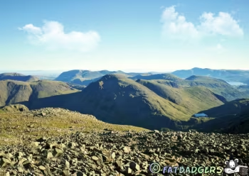
The greatest mountain region in Britain is the Scottish Highlands. The Highlands dominate northern and western Scotland and contain Britain’s highest peaks occupying the mountainous north and west of Scotland, the Highlands are often imagined as the “wild heart” of Britain: a land of glens, lochs, mist-covered mountains, ancient clans, ruined castles, Gaelic traditions, and dramatic weather shaped by the Atlantic Ocean. The region is famous for: • rugged mountains • deep glens • lochs • moorland • dramatic weather The Highlands are divided into several mountain systems.Grampian Mountains
The Grampians are the largest mountain region in Britain and form the central backbone of the Scottish Highlands. Stretching across much of central and eastern Scotland, they contain many of the highest and most dramatic mountains in the United Kingdom, including Ben Nevis, the tallest peak in Britain and include: • the Cairngorms • many of Britain’s highest peaks Most famously: • Ben Nevis (1,345 metres / 4,413 feet) Ben Nevis is the highest mountain in the UK and attracts climbers and walkers from around the world. The Cairngorms differ from many British mountains because they form a high plateau landscape rather than narrow jagged peaks. The eastern Grampians are closely linked with Scotch whisky production where the mountains provide clean water, cool climate and peat resources, all important for whisky making. Scotland has the largest and most northerly ski areas in the United Kingdom. Scottish skiing developed mainly during the twentieth century, especially after World War II, when road access and ski lifts improved in the Highlands. The five main lift-served ski areas are: • Cairngorm Mountain • Glenshee • Nevis Range • Glencoe Mountain • The Lecht Together they form the core of Scottish snowsports culture.Northwest Highlands
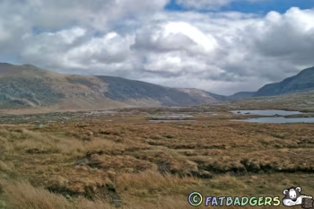
The Northwest Highlands are geologically ancient and often more dramatic. Famous mountains include: • Suilven • Stac Pollaidh • Liathach These mountains often rise abruptly from empty moorland, creating striking isolated shapes. The area is sparsely populated and visually wild. Unlike the more plateau-like Grampians and Cairngorms of eastern Scotland, the Northwest Highlands are defined by: • isolated peaks • dramatic rock formations • broken coastlines • sparse population • Atlantic weather The landscape often appears almost prehistoric - bare rock rising directly from moorland and sea.The Southern Uplands
South of the Highlands lie the Southern Uplands. These hills are generally: • lower • smoother • greener Historically they supported: • sheep farming • border communities • textile industries The Southern Uplands form a broad belt of hills and upland countryside stretching across southern Scotland from the Atlantic coast in the west to the North Sea in the east. Although overshadowed in popular imagination by the dramatic Scottish Highlands, the Southern Uplands are one of Britain’s great hill regions: vast, windswept, sparsely populated, and deeply tied to Scotland’s border history, pastoral economy and rural identity.The Pennines
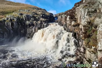
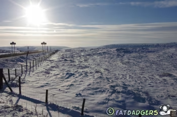
The Pennines are often called: “the backbone of England.” They stretch through northern England from Derbyshire to Northumberland. The Pennines are not especially high but are enormously important geographically and culturally. They shaped: • industrial development • settlement patterns • regional identity • transport routes The Pennines contain: • peat moorlands • limestone valleys • gritstone escarpments • sheep pasture Historically they formed a barrier between eastern and western England.Yorkshire Dales
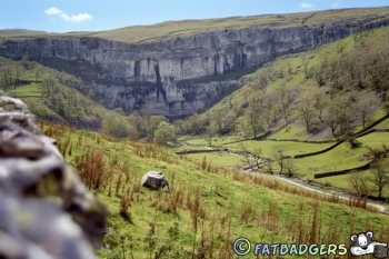
Part of the Pennine system, the Yorkshire Dales are one of the most celebrated rural landscapes in England - a region of limestone valleys, green hills, dry-stone walls, stone-built villages, caves, waterfalls and open moorland stretching across the central Pennines of northern England.: The word “dale” means valley, and the Yorkshire Dales are essentially a network of river valleys radiating through upland country. The region is famous for combining: • dramatic natural scenery • centuries of farming history • strong northern identity • literary and cultural associations The Dales are often seen as one of the quintessential images of rural northern England. Most valleys are carved by rivers flowing eastward from the Pennine uplands and the landscape is heavily shaped by farming and glaciation. Some of Britain’s best-known limestone features are here, including: • Malham Cove • Gordale Scar • the Three Peaks areaPeak District
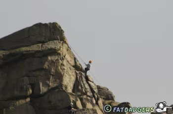
The Peak District became Britain’s first national park in 1951 and is one of the most important and beloved landscapes in England - a region of hills, moorlands, limestone valleys, gritstone edges, caves, reservoirs and old industrial villages lying at the southern end of the Pennines. It includes: • the Dark Peak (moorland gritstone) • the White Peak (limestone valleys) The Peak District was historically important for: • lead mining • quarrying • early hiking movements Famous features include: • Kinder Scout • Stanage Edge • Bleaklow The Peak District occupies a special place in British social history because of struggles over access to the countryside. In 1932 much upland terrain was privately restricted. Ramblers and working-class walkers protested for public access to open countryside and organised the Kinder Scout Mass Trespass of 1932. The trespass became symbolic of: • outdoor freedom • public rights • walking culture It helped influence the later creation of: • national parks • public footpaths • right-to-roam legislation The Dark Peak feels rugged and windswept, especially in poor weather.The Lake District
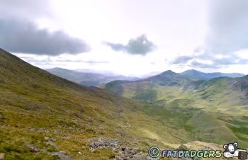
The Lake District contains England’s highest mountains. Famous peaks include: • Scafell Pike • Helvellyn • Skiddaw The area is known for: • steep fells • lakes • rocky ridges • heavy rainfall The Lake District inspired many Romantic writers, especially: • William Wordsworth Tourism and hiking are central to the modern regional economy.Welsh Mountains
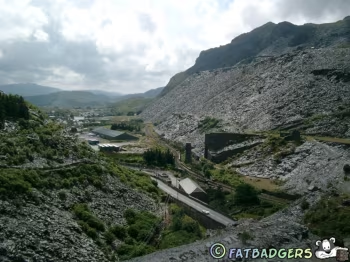
Wales is one of the most mountainous parts of Britain. Mountains dominate much of: • North Wales • Mid Wales Historically these uplands encouraged: • isolation • Welsh-language survival • sheep farming • quarrying • Snowdonia (Eryri) Snowdonia - officially called Eryri in Welsh - is the great mountain heartland of northern Wales and one of the most dramatic landscapes in the United Kingdom. It is a region of jagged peaks, glacial valleys, slate mountains, waterfalls, lakes, forests, and storm- lashed uplands deeply tied to Welsh language, culture and national identity. Snowdonia National Park was established in 1951, becoming one of Britain’s first national parks. Most famous: • Snowdon (Yr Wyddfa) At 1,085 metres (3,560 feet), it is the highest mountain in Wales. Snowdon is one of the most climbed mountains in Britain. Snowdonia has long occupied a powerful place in the imagination of Wales. To many people it represents: • the stronghold of Welsh culture • the landscape of Welsh resistance • the wild mountains of Celtic Britain • a symbol of national endurance The region combines: • extraordinary natural scenery • ancient geology • industrial history • strong Welsh-speaking traditions in a way unmatched elsewhere in Britain. Slate Industry During the nineteenth century, Snowdonia became one of the world’s great slate-producing regions. Huge quarries developed around: • Llanberis • Bethesda • Blaenau Ffestiniog Welsh slate roofed buildings across Britain and beyond. The industry transformed: • local communities • transport systems • mountain landscapes Enormous quarry scars remain visible today. The slate landscape of north-west Wales became a UNESCO World Heritage Site because of its industrial importance and still produces some of the best quality slate roofing tiles in the World.Brecon Beacons
Increasingly referred to officially as Bannau Brycheiniog in Welsh - are a broad upland region in southern Wales famous for sweeping grassy mountains, waterfalls, moorland, reservoirs, deep valleys and dramatic skies. Compared with the sharper and rockier mountains of Snowdonia, the Brecon Beacons are softer and greener, yet they possess a powerful atmosphere of openness, weather and solitude. They are famous for: • rounded peaks • hiking • waterfalls • military training The highest peak is Pen y Fan. The region occupies an important place in Welsh geography and identity because it forms the mountainous divide between: • industrial South Wales • rural mid-Wales Brecon Beacons National Park was established in 1957. The park became an International Dark Sky Reserve allowing exceptional views of stars, planets and the Milky Way.Dartmoor and Exmoor
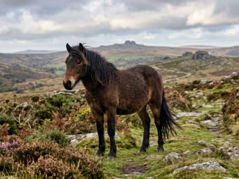
South-west England contains important upland moorland regions. Dartmoor The Dartmoor is one of the most distinctive upland landscapes in southern Britain - a vast granite moorland of tors, peat bogs, rivers, stone circles and open heather stretching across central Devon. Unlike the higher mountains of Wales or Scotland, Dartmoor feels less like a range of peaks and more like an ancient, weathered plateau shaped by wind, rain and deep geological time. The landscape is often described as: • wild but accessible • empty but not remote • rugged but rounded • ancient yet human-shaped It is one of England’s last large expanses of open moorland and has a strong sense of isolation despite being close to towns like Exeter and Plymouth. The moor is roughly circular and rises to over 600 metres at its highest points and the landscape feels ancient and isolated despite being relatively low. Key rivers begin here, including: • the Dart • the Tavy • the Teign • the Taw These rivers carve deep wooded valleys around the edges of the moor and the wildlife includes: • Dartmoor ponies (semi-wild herds) • red deer • skylarks • peregrine falcons The ponies are particularly iconic - grazing freely across the moor and shaping its vegetation. Exmoor The Exmoor is a rugged upland and coastal landscape in south-west England, straddling the border between Somerset and Devon. Alongside Dartmoor, it forms one of England’s most important moorland regions - a place of heather-covered hills, deep wooded valleys, dramatic cliffs, and fast- flowing rivers. It is wetter and greener than much of southern England. Exmoor has a quieter, more intimate character than Dartmoor. It is less vast and less stark, but often more varied — where open moorland quickly drops into steep river valleys and then suddenly into sea cliffs. It is part national park and part coastal wilderness, giving it a dual identity: • inland moorland uplands • Atlantic-edge coastline Although lower than Dartmoor, Exmoor still reaches over 500 metres in places. The terrain feels rolling rather than flat, enclosed rather than vast and varied rather than uniform. It is shaped strongly by wind, rain and Atlantic weather systems and one of Exmoor’s most distinctive features is its dramatic coastline along the Bristol Channel and key species include: • Exmoor ponies (one of Britain’s oldest horse breeds) • red deer • buzzards • peregrine falcons • otters in river valleys The ponies are particularly iconic, grazing freely and helping maintain the moorland ecosystem.Hills of Southern England
Southern England is generally lower but still contains famous hill systems. These include: • the Cotswolds • the Chilterns • the North Downs • the South Downs These landscapes are characterised by: • rolling farmland • chalk ridges • beech woodland • historic villages Unlike the rugged uplands of the north and west, they are softer and more agricultural.Cultural Importance
Britain’s mountains and hills deeply shaped national culture. They influenced: • regional identities • dialect boundaries • agriculture • industrialization • warfare • literature Mountain landscapes became especially important during the Romantic movement, when writers and artists celebrated wild scenery. The uplands are also tied to: hiking culture conservation national parks ideas of wildernessNational Parks and Recreation
Many mountain areas became protected landscapes during the twentieth century. Major national parks include: • Lake District • Snowdonia • Cairngorms • Peak District • Yorkshire Dales • Dartmoor These regions attract millions of visitors for: • hiking • climbing • camping • cycling • wildlife watching Public access to uplands became an important political issue, especially after events such as the 1932 Kinder Scout mass trespass in the Peak District.Mountains and British Identity
Although Britain lacks giant alpine ranges, its hills and mountains are central to how the country imagines itself. • The Highlands symbolize Scottish identity. • The Lake District symbolizes Romantic England. • Snowdonia symbolizes Welsh national culture. • The Pennines symbolize northern England. Together these landscapes helped create Britain’s regional diversity and continue to shape how people experience the country today.







Mountains and Hills of Britain
Whilst the UK doesn’t have the majestic peaks of the Rockies or the Alps, there is still some spectacular views to behold and some fabulous walking
and climbing areas.















 Pubs
Pubs Open Map in New Window
 England
 Scotland
 Wales
Wales Ireland
 County Map
 About Britain
 Pubs
Pubs British Beer
 Perfect Pint
 Beer Glasses
 The Barren Years
 Real Fires
 Breweries
 Brewing
 British Food
 Recipes
 Pub Interiors
 Dog Friendly
 Pub Games
 Strange Pub Names
 Visitor Information
 Oldest Pub
 Pub Signs
 Micropubs
 Buildings
 Cathedrals
 Stately Homes
 Castles
 Listed Buildings
 Scheduled Monuments
 Oak Framing
 Architecture
 Thatching
 Waterways
 Sailing
 Shipbuilding
 Boatbuilding
  Shipping Forecast
 Britain's Coastline
 Coastal Locations
 Piers
Piers Lighthouses
 Harbours
 Beach Safety
 British Beaches
 Canals
 Rivers
 Islands
 Lakes
Lakes Waterfalls
 Historical
 Famous People
 Kings & Queens
 Kings of England
 History of Britain
 Industrial Revolution
 Act of Union
 Beaufort Scale
 British Firsts
 World Heritage Sites
 Historical Periods
 Historical Boundaries
 Tradition & Culture
 Morris Dancing
 Film & Television
 Television
 Calendar of Events
 British Sport
 Scottish Highlands
 Money
Money Dry Stone Walling
 British Wildlife
 Class System
 Geographical
 Pub Boundaries
 Facts 'n' Figures
 British Isles
 Other Areas
 Place Name Origins
 Topography
 Suggest an Inn
 Explanation of symbols
 Why Us?
 Places to Visit
 Long Distance Paths
 National Parks
 Areas of Outstanding Natural Beauty
 Coastal Locations
 Other areas of Britain
 Maps
Maps Our Favourite Locations
 Search
 Focus On...
 News
News Contact
 About Us
 Our History
 Donate